MyTopo
Clyde Park Montana US Topo Map
Couldn't load pickup availability
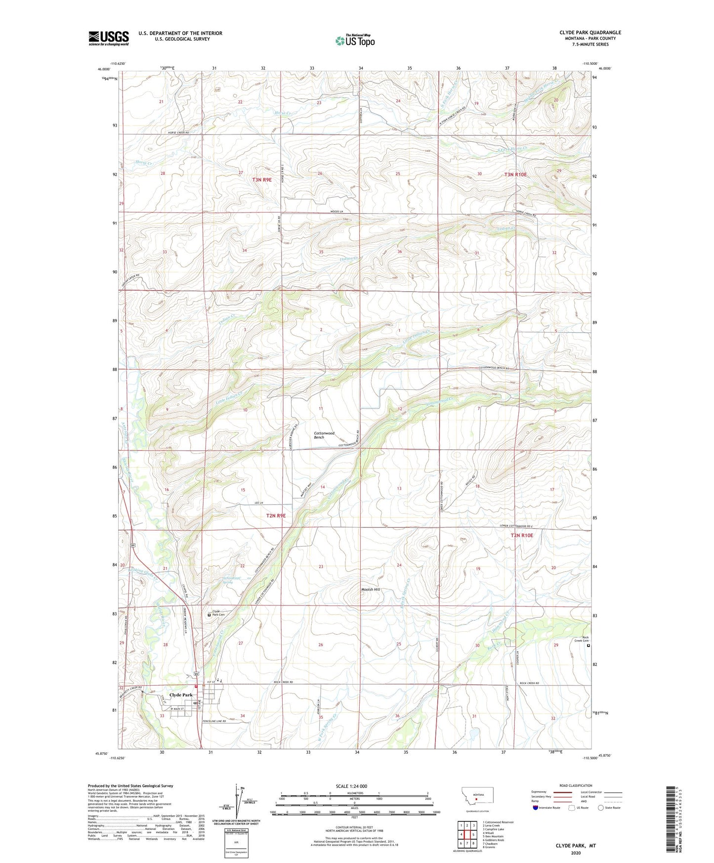
2024 topographic map quadrangle Clyde Park in the state of Montana. Scale: 1:24000. Based on the newly updated USGS 7.5' US Topo map series, this map is in the following counties: Park. The map contains contour data, water features, and other items you are used to seeing on USGS maps, but also has updated roads and other features. This is the next generation of topographic maps. Printed on high-quality waterproof paper with UV fade-resistant inks.
Quads adjacent to this one:
West: Wilsall
Northwest: Cottonwood Reservoir
North: Lena Creek
Northeast: Campfire Lake
East: Ibex Mountain
Southeast: Grannis
South: Chadborn
Southwest: Gobblers Knob
This map covers the same area as the classic USGS quad with code o45110h5.
Contains the following named places: 02N09E22C___01 Spring, 02N09E24B___01 Well, 02N09E26CD__01 Well, 02N09E33B___01 Well, 02N10E18CB__01 Well, 03N09E23C___01 Well, 03N09E24C___01 Well, 03N09E24C___02 Well, 03N09E25B___01 Well, 03N10E32B___01 Well, Antelope Creek, Basin Creek, Brown Ranch, Carroll Ranch, Chose Ranch, Clyde Park, Clyde Park Cemetery, Clyde Park City Fire Department, Clyde Park Post Office, Clyde Park Rural Volunteer Fire Department, Clyde Park Station, Clyde Park United Methodist Church, Cottonwood Bench, Cottonwood Creek, De Atley Ranch, Egler Ranch, Fisher Ranch, Hammond Creek, Holliday Ranch, Hunter Ranch, Indian Creek, Julian Ranch, Kensfather Ranch, Keys Ranch, Lee Ranch, Little Indian Creek, Logan Ranch, Looking Glass Creek, Lovely Ranch, McClung Ranch, Middle Fork Horse Creek, Miller Ranch, Moolsh Hill, Morrison Ranch, North Fork Horse Creek, Olsen Ranch, Rock Creek Cemetery, Saint Margarets Catholic Church, Shields Valley Bible Church, Shields Valley Division, Shields Valley Grain Incorporated Elevator, Shields Valley High School, Shields Valley Junior High School, South Fork Horse Creek, Sumner School, Thompson Ranch, Town of Clyde Park