MyTopo
Wilsall Montana US Topo Map
Couldn't load pickup availability
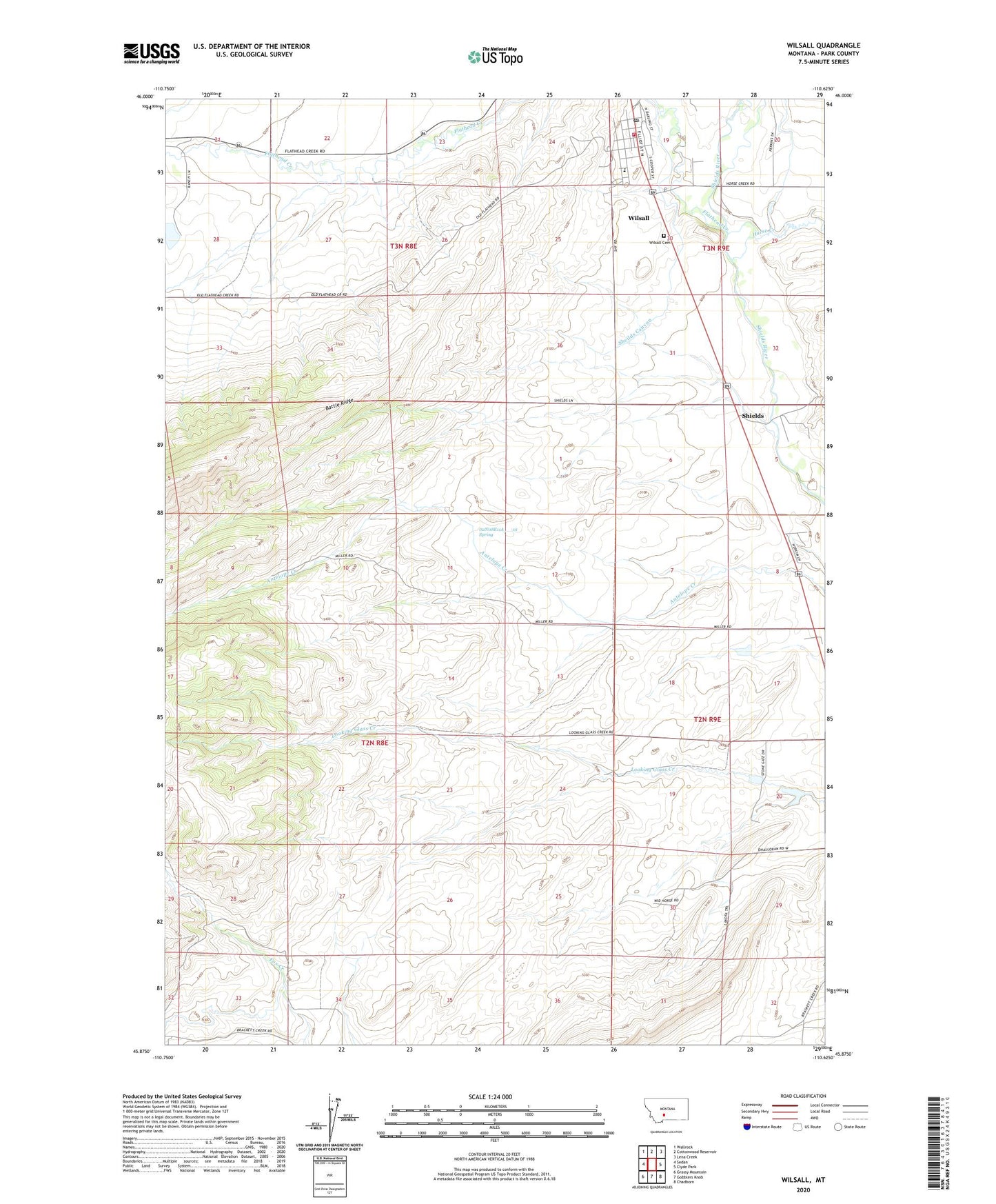
2024 topographic map quadrangle Wilsall in the state of Montana. Scale: 1:24000. Based on the newly updated USGS 7.5' US Topo map series, this map is in the following counties: Park. The map contains contour data, water features, and other items you are used to seeing on USGS maps, but also has updated roads and other features. This is the next generation of topographic maps. Printed on high-quality waterproof paper with UV fade-resistant inks.
Quads adjacent to this one:
West: Sedan
Northwest: Wallrock
North: Cottonwood Reservoir
Northeast: Lena Creek
East: Clyde Park
Southeast: Chadborn
South: Gobblers Knob
Southwest: Grassy Mountain
This map covers the same area as the classic USGS quad with code o45110h6.
Contains the following named places: 02N08E11A___01 Spring, 02N08E11B___01 Well, 02N09E05B___01 Well, 02N09E17C___01 Well, 03N08E26A___01 Well, 03N08E28C___01 Well, 03N09E19C___01 Well, 03N09E19C___02 Well, 03N09E19C___03 Well, 03N09E19C___04 Well, 03N09E19C___05 Well, 03N09E30A___01 Well, Arthun Dam, Brackett Creek School, D'Ewart Dam, Farmers Exchange Elevator, Flathead Creek, Horse Creek, Meyersburg School, O'Halloran Dam, O'Halloran Number 1 Dam, Potter, Shields, Shields Post Office, Shields River Lutheran Church, Shields River Valley Historical Marker, Shields School, Shields Valley Elementary School, Shields Valley Grain Incorporated Elevator, Wilsall, Wilsall Cemetery, Wilsall Census Designated Place, Wilsall Community Church, Wilsall Fire Department, Wilsall Post Office, Wilsall United Methodist Church