MyTopo
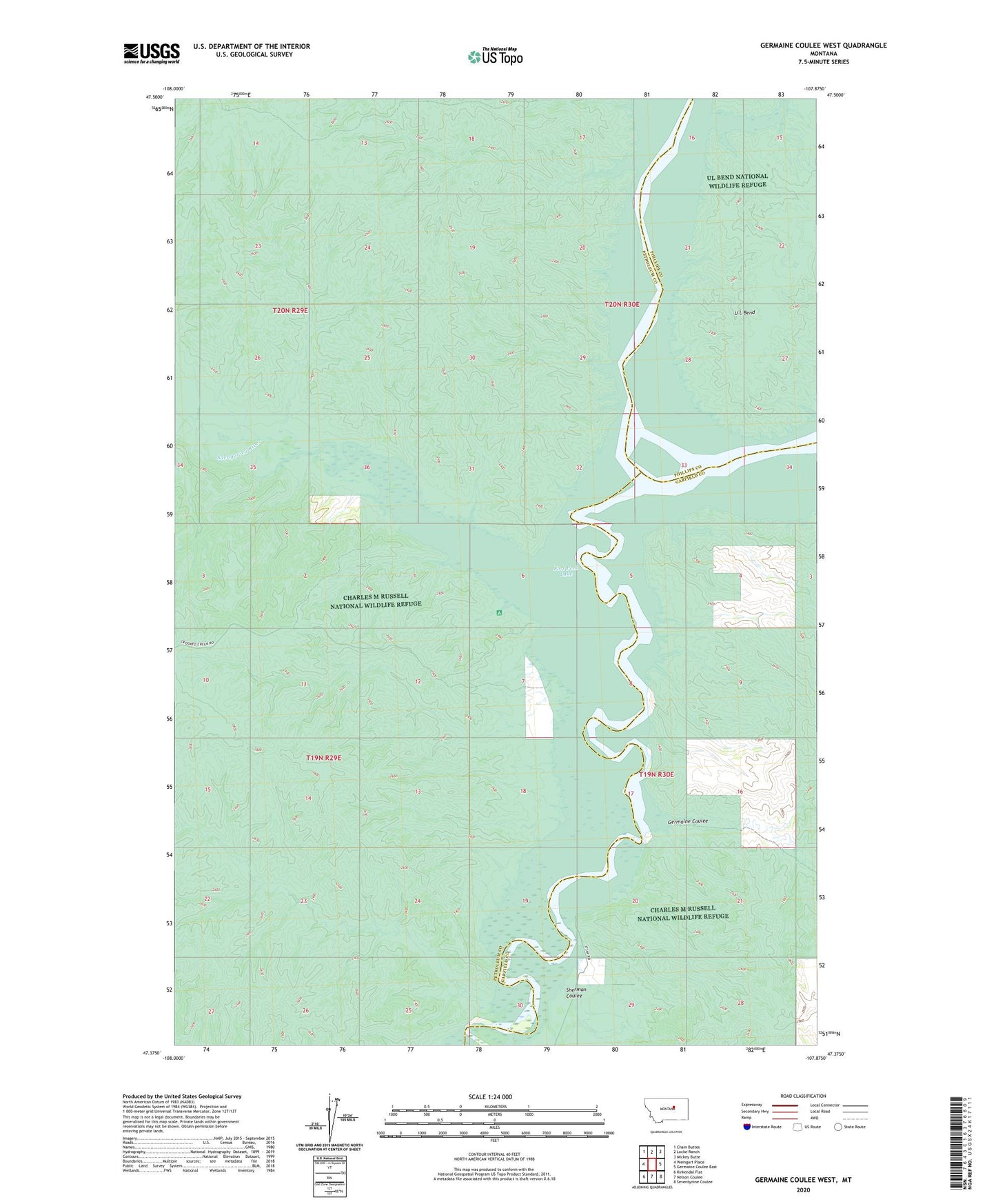
Germaine Coulee West Montana US Topo Map
Couldn't load pickup availability
2024 topographic map quadrangle Germaine Coulee West in the state of Montana. Scale: 1:24000. Based on the newly updated USGS 7.5' US Topo map series, this map is in the following counties: Petroleum, Garfield, Phillips. The map contains contour data, water features, and other items you are used to seeing on USGS maps, but also has updated roads and other features. This is the next generation of topographic maps. Printed on high-quality waterproof paper with UV fade-resistant inks.
Quads adjacent to this one:
West: Weingart Place
Northwest: Chain Buttes
North: Locke Ranch
Northeast: Mickey Butte
East: Germaine Coulee East
Southeast: Seventynine Coulee
South: Nelson Coulee
Southwest: Kirkendal Flat
This map covers the same area as the classic USGS quad with code o47107d8.
Contains the following named places: Camp Reeve, Crooked Creek Campground, Crooked Creek Recreation Area, Downes Trading Post, Fort Musselshell, Fort Musselshell School, Fort Sheridan, Germaine Coulee, Jim Wells Creek, Kismet Post Office, Muscleshell City, New Rukavina School, Sacagawea River, Sherman Coulee, Smithson, U L Bend, Vincent Post Office, Weingart Home School