MyTopo
Locke Ranch Montana US Topo Map
Couldn't load pickup availability
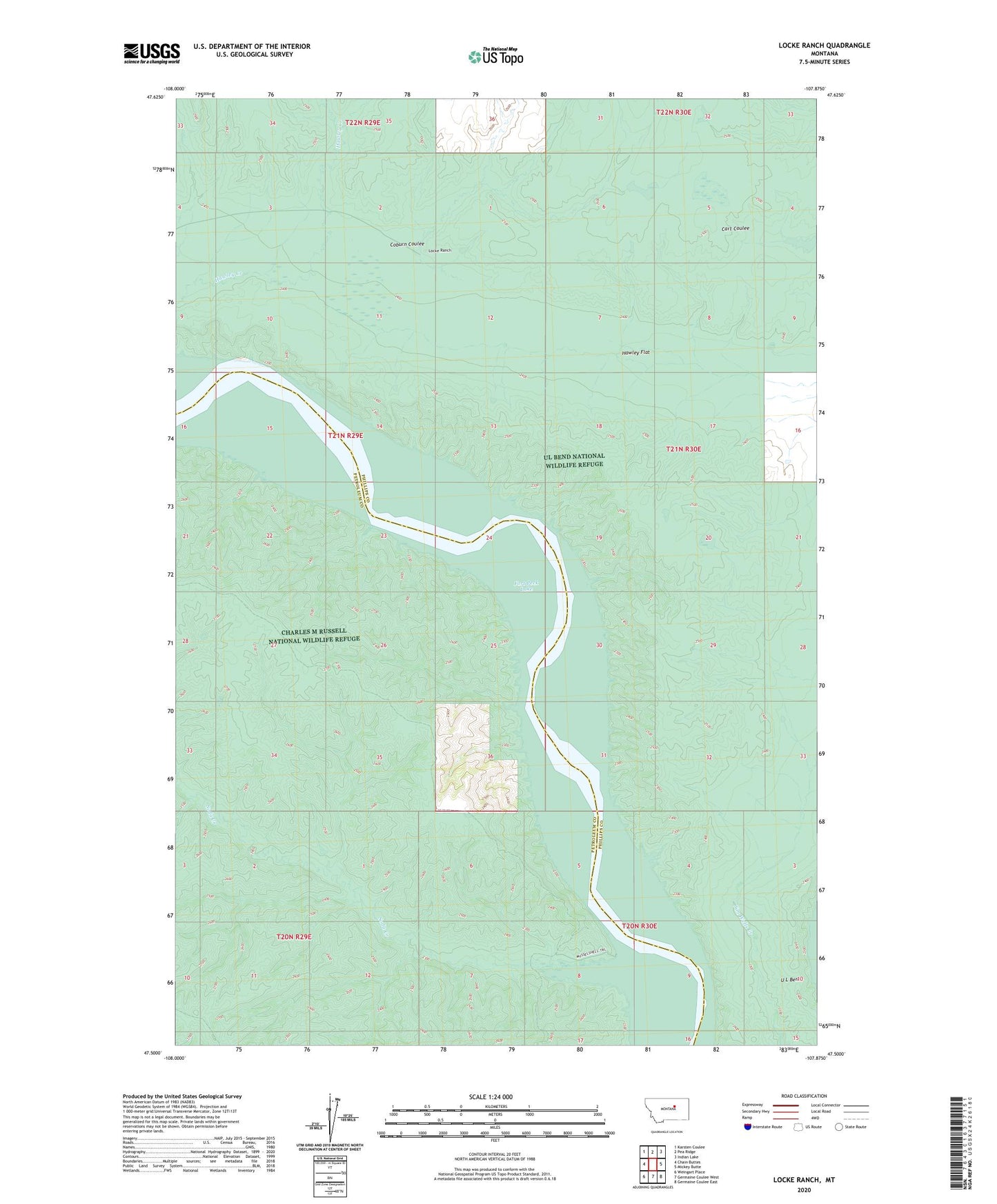
2024 topographic map quadrangle Locke Ranch in the state of Montana. Scale: 1:24000. Based on the newly updated USGS 7.5' US Topo map series, this map is in the following counties: Phillips, Petroleum. The map contains contour data, water features, and other items you are used to seeing on USGS maps, but also has updated roads and other features. This is the next generation of topographic maps. Printed on high-quality waterproof paper with UV fade-resistant inks.
Quads adjacent to this one:
West: Chain Buttes
Northwest: Karsten Coulee
North: Pea Ridge
Northeast: Indian Lake
East: Mickey Butte
Southeast: Germaine Coulee East
South: Germaine Coulee West
Southwest: Weingart Place
This map covers the same area as the classic USGS quad with code o47107e8.
Contains the following named places: 20N30E04CCB_01 Well, 21N29E01CC__01 Well, 21N29E02DABB01 Well, 21N30E08CB__01 Well, 24N30E32D___01 Well, Bervie Post Office, Coburn Coulee, Hawley Flat, Legg, Legg Post Office, Locke Ranch, Mable Number 2 Dam, Peck Cart Dam, Soda Creek, U L Bend, U L School, UL Bend National Wildlife Refuge, UL Bend Wilderness, Veseth and Veseth Number 4 Dam