MyTopo
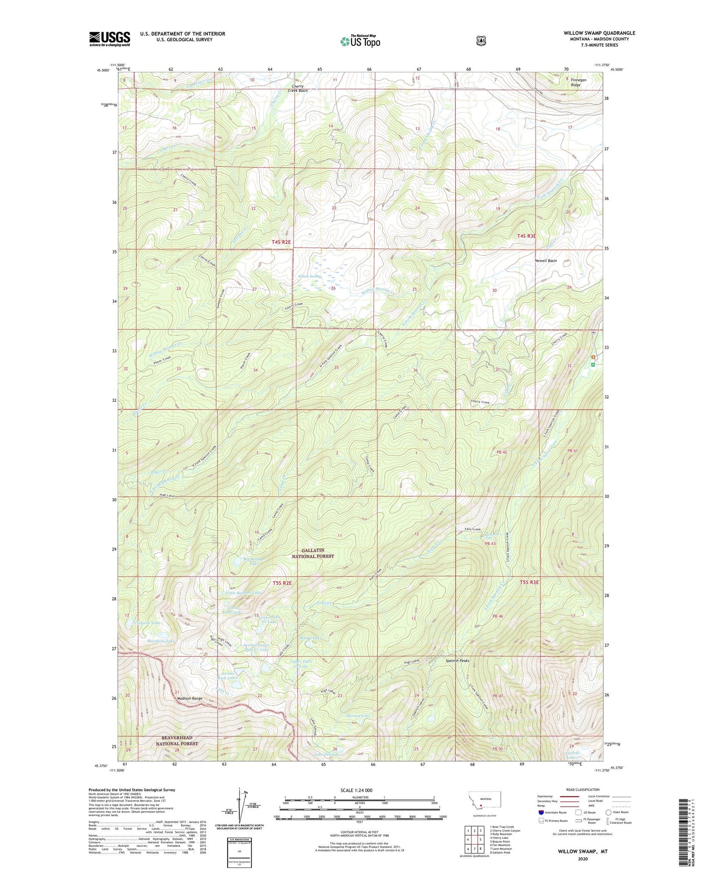
Willow Swamp Montana US Topo Map
Couldn't load pickup availability
Also explore the Willow Swamp Forest Service Topo of this same quad for updated USFS data
2024 topographic map quadrangle Willow Swamp in the state of Montana. Scale: 1:24000. Based on the newly updated USGS 7.5' US Topo map series, this map is in the following counties: Madison. The map contains contour data, water features, and other items you are used to seeing on USGS maps, but also has updated roads and other features. This is the next generation of topographic maps. Printed on high-quality waterproof paper with UV fade-resistant inks.
Quads adjacent to this one:
West: Cherry Lake
Northwest: Bear Trap Creek
North: Cherry Creek Canyon
Northeast: Ruby Mountain
East: Beacon Point
Southeast: Gallatin Peak
South: Lone Mountain
Southwest: Fan Mountain
This map covers the same area as the classic USGS quad with code o45111d4.
Contains the following named places: Alder Creek, Big Brother Lake, Camp Creek, Chiquita Lake, Cuff Creek, Falls Creek, Hermit Lake, Jerome Rock Lakes, Lake Solitude, Little Brother Lake, Little Sister Lake, Lower Falls Creek Lake, Marcheta Lake, Margo Lake, Newell Basin, Pioneer Falls, Placer Creek, Placer Creek Mine, Second Lower Falls Creek Lake, South Fork Cherry Creek, Spanish Creek Recreation Site, Spanish Post Office, Sweden Creek, Upper Falls Creek Lake, Willow Swamp, Willow Swamp Creek