MyTopo
Cherry Lake Montana US Topo Map
Couldn't load pickup availability
Also explore the Cherry Lake Forest Service Topo of this same quad for updated USFS data
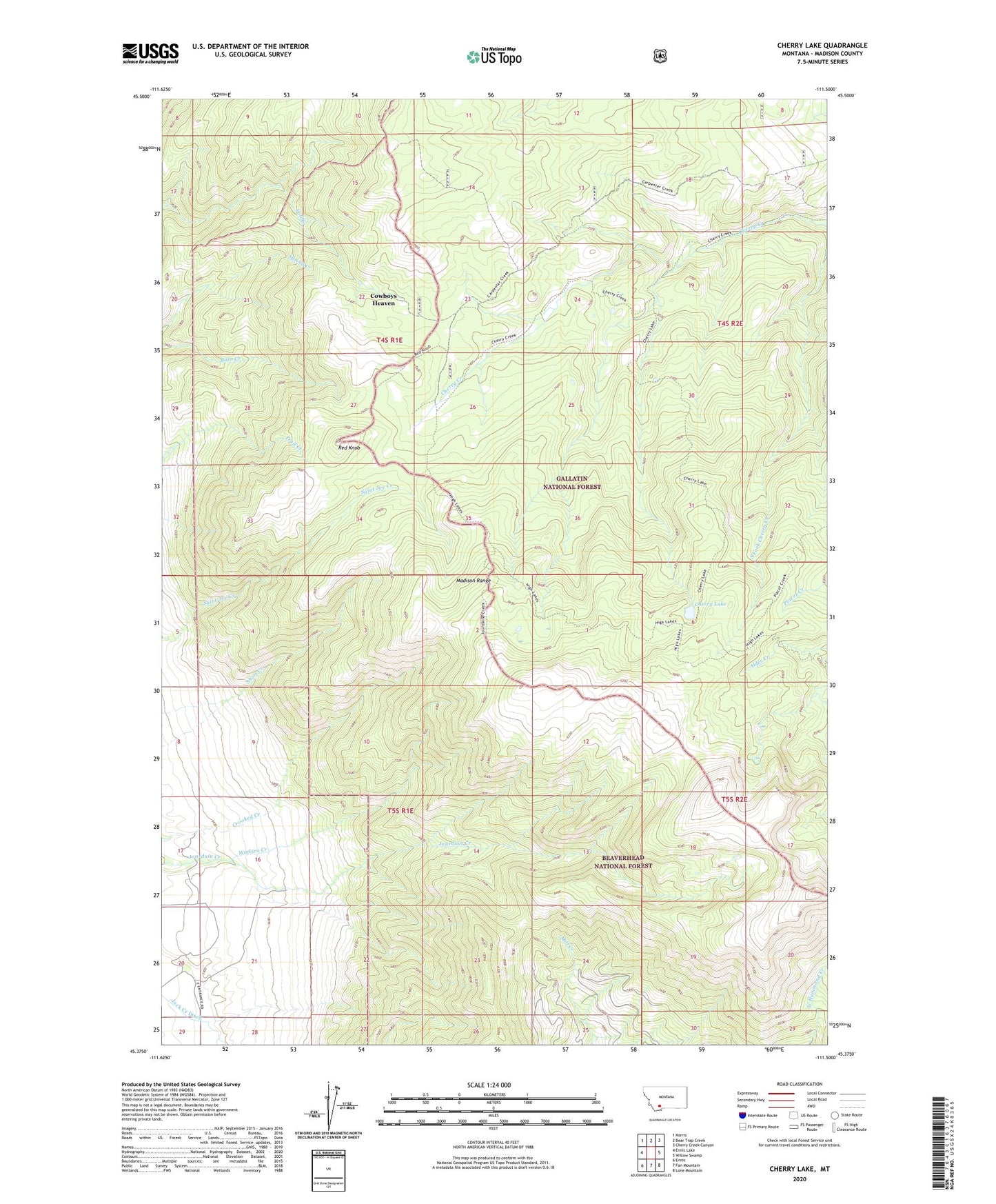
2024 topographic map quadrangle Cherry Lake in the state of Montana. Scale: 1:24000. Based on the newly updated USGS 7.5' US Topo map series, this map is in the following counties: Madison. The map contains contour data, water features, and other items you are used to seeing on USGS maps, but also has updated roads and other features. This is the next generation of topographic maps. Printed on high-quality waterproof paper with UV fade-resistant inks.
Quads adjacent to this one:
West: Ennis Lake
Northwest: Norris
North: Bear Trap Creek
Northeast: Cherry Creek Canyon
East: Willow Swamp
Southeast: Lone Mountain
South: Fan Mountain
Southwest: Ennis
This map covers the same area as the classic USGS quad with code o45111d5.
Contains the following named places: Cherry Creek Ranger Station, Cherry Lake, Cowboys Heaven, Jack Creek Ditch, Jack Creek Ranch, Jumping Horse Stock Ranch, Lone Acre Lake, Red Knob, Watkins Creek