MyTopo
Chester Montana US Topo Map
Couldn't load pickup availability
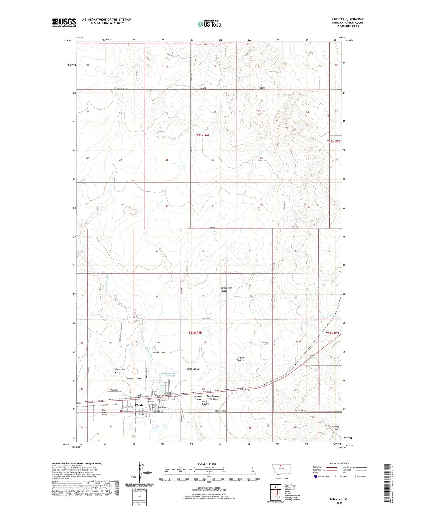
2024 topographic map quadrangle Chester in the state of Montana. Scale: 1:24000. Based on the newly updated USGS 7.5' US Topo map series, this map is in the following counties: Liberty. The map contains contour data, water features, and other items you are used to seeing on USGS maps, but also has updated roads and other features. This is the next generation of topographic maps. Printed on high-quality waterproof paper with UV fade-resistant inks.
Quads adjacent to this one:
West: Tiber
Northwest: Lakey Ranch
North: Chester NW
Northeast: Chester NE
East: Joplin
Southeast: Poverty Coulee NE
South: Poverty Coulee
Southwest: Sagebrush Coulee
This map covers the same area as the classic USGS quad with code o48110e8.
Contains the following named places: 32N06E12ADDD01 Well, 32N14E30CBBA01 Well, 33N06E22BCCD01 Well, Alma Coulee, Assembly of God Church, Badger Coulee, Bison Coulee, Chester, Chester Alliance Church, Chester Cemetery, Chester City Park, Chester City Water Supply Number 1 Dam, Chester City Water Supply Number 2 Dam, Chester Post Office, Chester Public Schools, Chester Rest Area, Chester Volunteer Fire Department, Clayton Coulee, East Branch Alma Coulee, Erin, Gagnon Reservoir Dam, General Mills Incorporated Elevator, Great Northern Reservoir, Harvest States Cooperative Elevator, Heimbigner Coulee, Keith Coulee, Liberty County Airport, Liberty County Courthouse, Liberty County Library, Liberty County Museum, Liberty County Nursing Home, Liberty County Sheriff, Liberty Medical Center, Mary Lynn Hospital, Our Savior Lutheran Church, Saint Marys Catholic Church, The Church of Jesus Christ of Latter Day Saints, Town of Chester, Triangle Health Care