MyTopo
Coburn Mountain Montana US Topo Map
Couldn't load pickup availability
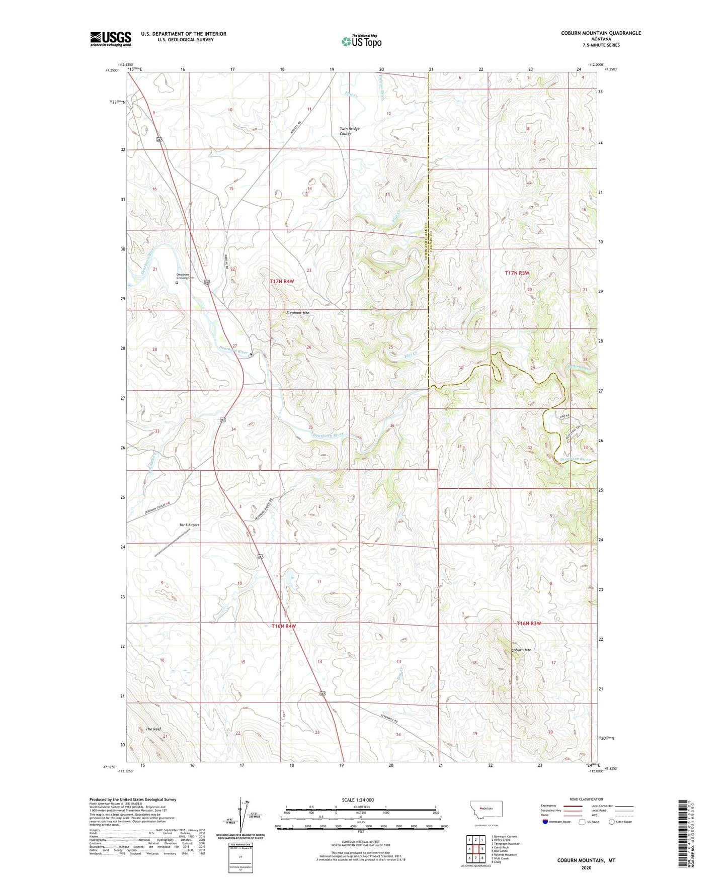
2020 topographic map quadrangle Coburn Mountain in the state of Montana. Scale: 1:24000. Based on the newly updated USGS 7.5' US Topo map series, this map is in the following counties: Lewis and Clark, Cascade. The map contains contour data, water features, and other items you are used to seeing on USGS maps, but also has updated roads and other features. This is the next generation of topographic maps. Printed on high-quality waterproof paper with UV fade-resistant inks.
Quads adjacent to this one:
West: Comb Rock
Northwest: Bowmans Corners
North: Henry Creek
Northeast: Telegraph Mountain
East: Mid Canon
Southeast: Craig
South: Wolf Creek
Southwest: Roberts Mountain
Contains the following named places: Bar E Airport, Coburn Mountain, Curran-Barrett Number 1 Dam, Deadman Creek, Dearborn, Dearborn Crossing Cemetery, Dearborn Post Office, Dearborn Ranch, Elephant Mountain, Flat Creek, Sevenmile School, Sullivan Creek, Twin Bridge Coulee