MyTopo
Roberts Mountain Montana US Topo Map
Couldn't load pickup availability
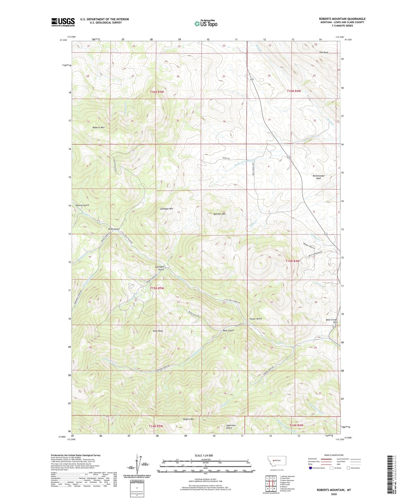
2024 topographic map quadrangle Roberts Mountain in the state of Montana. Scale: 1:24000. Based on the newly updated USGS 7.5' US Topo map series, this map is in the following counties: Lewis and Clark. The map contains contour data, water features, and other items you are used to seeing on USGS maps, but also has updated roads and other features. This is the next generation of topographic maps. Printed on high-quality waterproof paper with UV fade-resistant inks.
Quads adjacent to this one:
West: Rogers Pass
Northwest: Johnson Mountain
North: Comb Rock
Northeast: Coburn Mountain
East: Wolf Creek
Southeast: Sheep Creek
South: Mitchell Mountain
Southwest: Wilborn
This map covers the same area as the classic USGS quad with code o47112a2.
Contains the following named places: A Hicks Ranch, Allen Gulch, B Hicks Ranch, Bear Gulch, Butcher Mountain, Cabin Ranch, Carter Creek, Denton Gulch, Foster Gulch, French Creek, Garrow Ranch, Gladstone Creek, Greenpole Creek, Johnson Homestead, Lannigan Gulch, Lannigan Mountain, Rattlesnake Reef, Roberts Mountain, Rogers Creek, Rogers Mountain, Rosetta Mine, Toms Peak, Wells Fork Rock Creek, Willis Creek, Wolf Creek Hill, Woods Creek, ZIP Code: 59648