MyTopo
Craig Montana US Topo Map
Couldn't load pickup availability
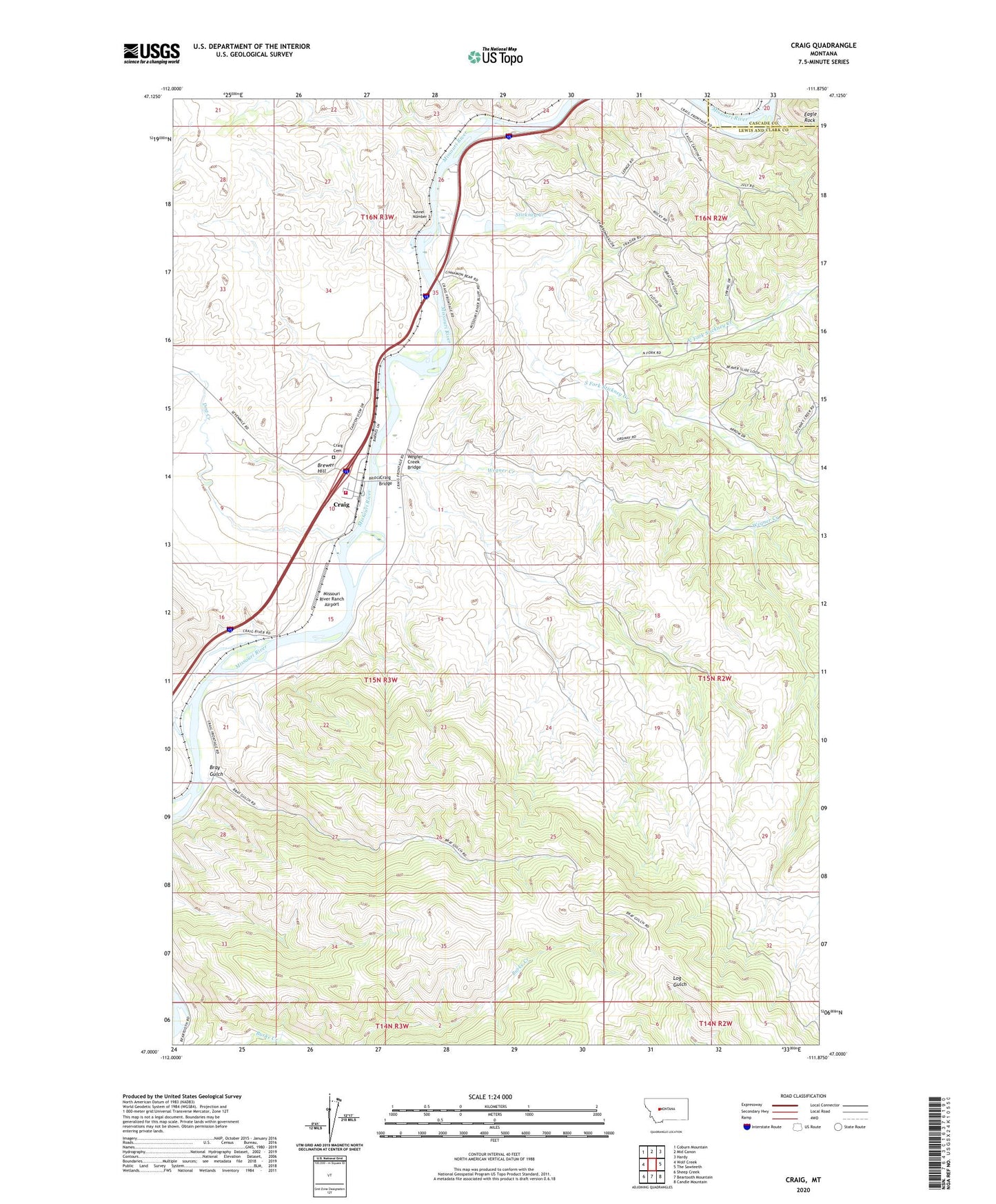
2024 topographic map quadrangle Craig in the state of Montana. Scale: 1:24000. Based on the newly updated USGS 7.5' US Topo map series, this map is in the following counties: Lewis and Clark, Cascade. The map contains contour data, water features, and other items you are used to seeing on USGS maps, but also has updated roads and other features. This is the next generation of topographic maps. Printed on high-quality waterproof paper with UV fade-resistant inks.
Quads adjacent to this one:
West: Wolf Creek
Northwest: Coburn Mountain
North: Mid Canon
Northeast: Hardy
East: The Sawteeth
Southeast: Candle Mountain
South: Beartooth Mountain
Southwest: Sheep Creek
This map covers the same area as the classic USGS quad with code o47111a8.
Contains the following named places: Billings Slough, Bray Gulch, Brewer Hill, Craig, Craig Bridge, Craig Cemetery, Craig Census Designated Place, Craig Elementary School, Craig Fishing Access Site, Craig Post Office, Dearborn, Dog Creek, Eagle Rock, Missouri River Ranch Airport, North Fork Stickney Creek, South Fork Stickney Creek, Spite Hill Fishing Access Site, Stickney Creek, Stickney Creek Fishing Access Site, Tunnel Number 3, Wegner Creek, Wegner Creek Bridge, Wolf Creek - Craig Fire Department Station 1