MyTopo
Comb Rock Montana US Topo Map
Couldn't load pickup availability
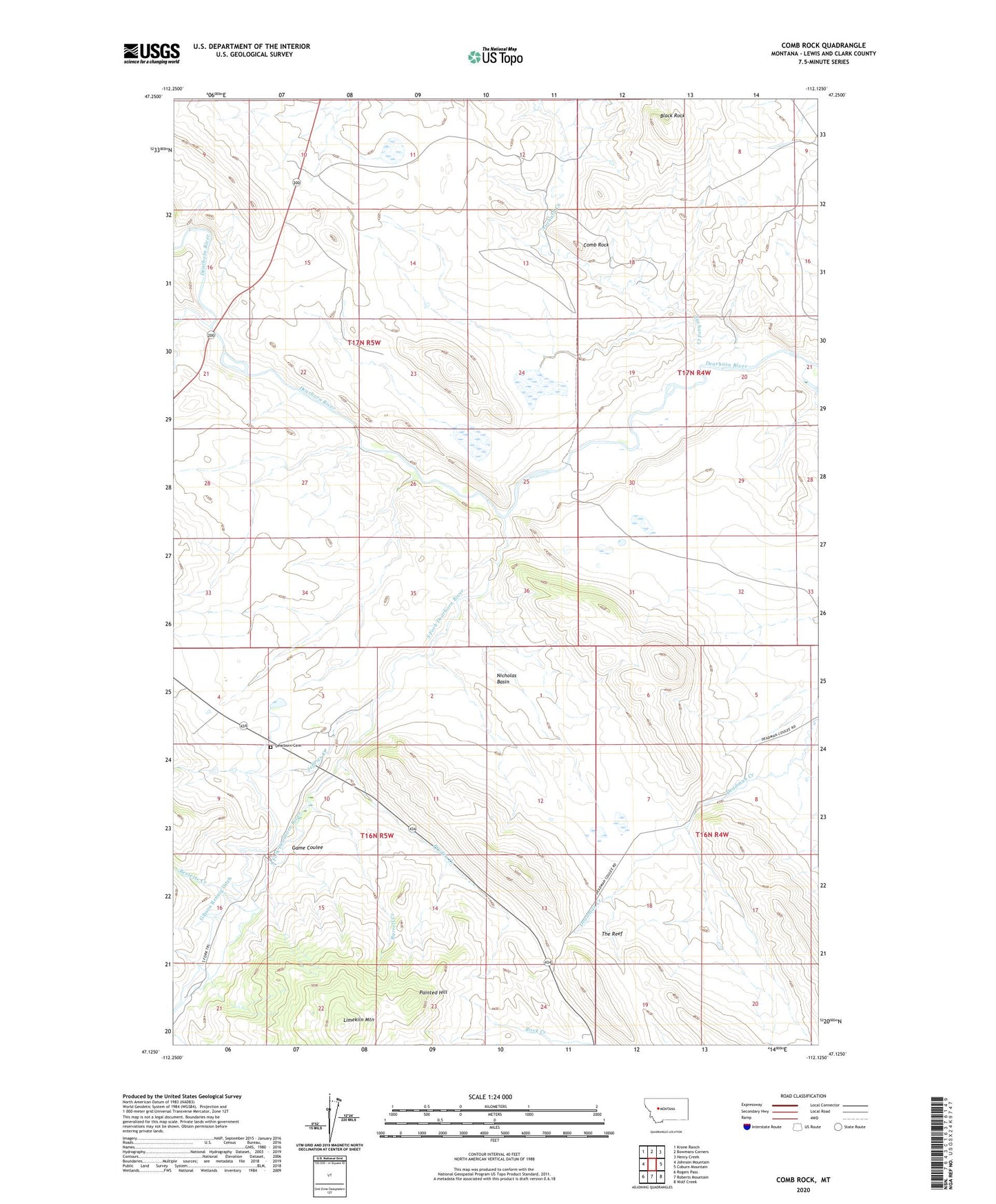
2024 topographic map quadrangle Comb Rock in the state of Montana. Scale: 1:24000. Based on the newly updated USGS 7.5' US Topo map series, this map is in the following counties: Lewis and Clark. The map contains contour data, water features, and other items you are used to seeing on USGS maps, but also has updated roads and other features. This is the next generation of topographic maps. Printed on high-quality waterproof paper with UV fade-resistant inks.
Quads adjacent to this one:
West: Johnson Mountain
Northwest: Krone Ranch
North: Bowmans Corners
Northeast: Henry Creek
East: Coburn Mountain
Southeast: Wolf Creek
South: Roberts Mountain
Southwest: Rogers Pass
This map covers the same area as the classic USGS quad with code o47112b2.
Contains the following named places: Auchard Creek, Barrell Creek, Bessette Creek, Black Rock, Blacktail Ranch, Burggraff Ranch, Comb Rock, Dearborn Cemetery, Dearborn Memorial Chapel, Fulton Post Office, Fulton School, Game Coulee, Gibson Rennig Ditch, Jeffries Creek, Johnson Creek, Limekiln Mountain, Middle Fork Dearborn River, Murphy Ranch, Nicholas Basin, Ostle Ranch, Painted Hill, Pruden Creek, South Fork Dearborn River, South Fork School