MyTopo
Telegraph Mountain Montana US Topo Map
Couldn't load pickup availability
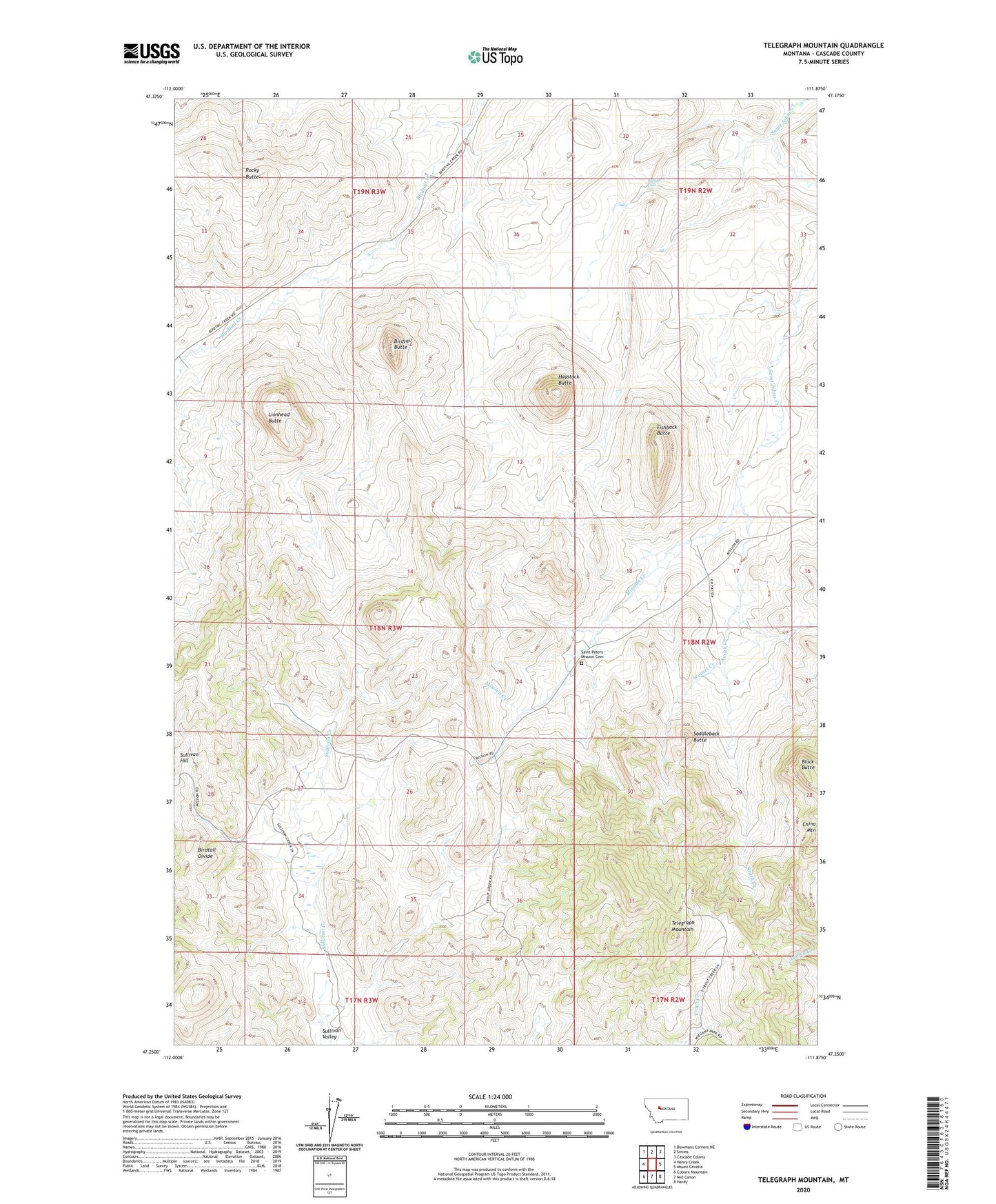
2024 topographic map quadrangle Telegraph Mountain in the state of Montana. Scale: 1:24000. Based on the newly updated USGS 7.5' US Topo map series, this map is in the following counties: Cascade. The map contains contour data, water features, and other items you are used to seeing on USGS maps, but also has updated roads and other features. This is the next generation of topographic maps. Printed on high-quality waterproof paper with UV fade-resistant inks.
Quads adjacent to this one:
West: Henry Creek
Northwest: Bowmans Corners NE
North: Simms
Northeast: Cascade Colony
East: Mount Cecelia
Southeast: Hardy
South: Mid Canon
Southwest: Coburn Mountain
This map covers the same area as the classic USGS quad with code o47111c8.
Contains the following named places: Bird Tail Post Office, Birdtail Butte, Birdtail Divide, Black Butte, Buffalo Falls, Dear Ranch, Fishback Butte, Haystack Butte, Lionhead Butte, Mission Creek, Mount Angela School for Girls, Rocky Butte, Saddleback Butte, Saint Peter, Saint Peter Post Office, Saint Peters Mission, Saint Peters Mission Cemetery, Saint Peters Mission Church, Smith Creek, Sullivan School, Sullivan Valley, Telegraph Mountain, Weasel Creek