MyTopo
Henry Creek Montana US Topo Map
Couldn't load pickup availability
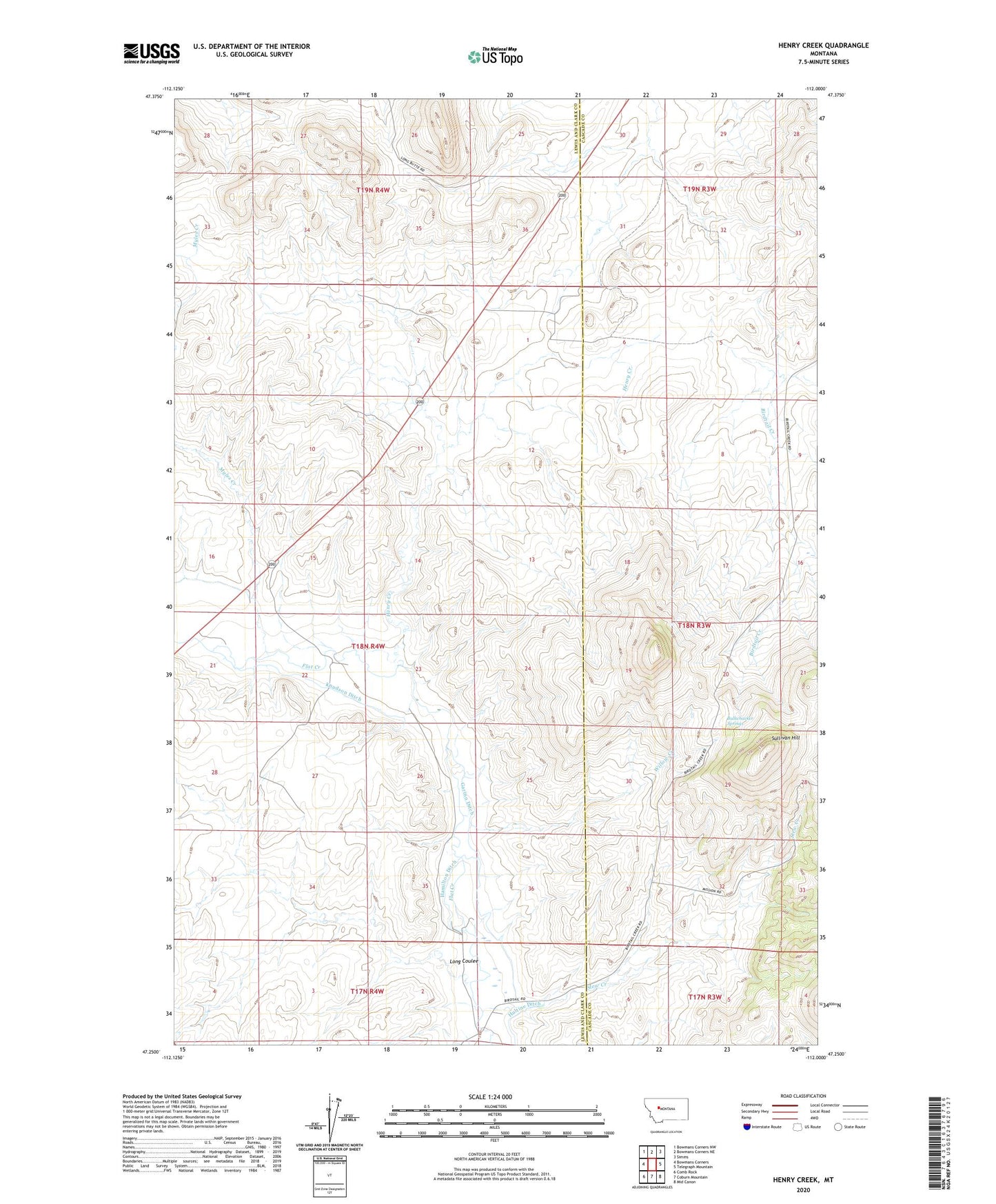
2024 topographic map quadrangle Henry Creek in the state of Montana. Scale: 1:24000. Based on the newly updated USGS 7.5' US Topo map series, this map is in the following counties: Lewis and Clark, Cascade. The map contains contour data, water features, and other items you are used to seeing on USGS maps, but also has updated roads and other features. This is the next generation of topographic maps. Printed on high-quality waterproof paper with UV fade-resistant inks.
Quads adjacent to this one:
West: Bowmans Corners
Northwest: Bowmans Corners NW
North: Bowmans Corners NE
Northeast: Simms
East: Telegraph Mountain
Southeast: Mid Canon
South: Coburn Mountain
Southwest: Comb Rock
This map covers the same area as the classic USGS quad with code o47112c1.
Contains the following named places: Beartooth Ranch, Birdtail Divide School, Bullwhacker Springs, Dear Ranch, Frank Thompson Dam, Garino Ditch, Garlipee Ranch, Hamilton Ditch, Henry Creek, Hultine Ditch, Kennedy Ranch, Knudson Ditch, Lees Halfway House, Levine Ranch, Long Coulee, Slew Creek, Sullivan Hill, Willow Creek