MyTopo
Colstrip East Montana US Topo Map
Couldn't load pickup availability
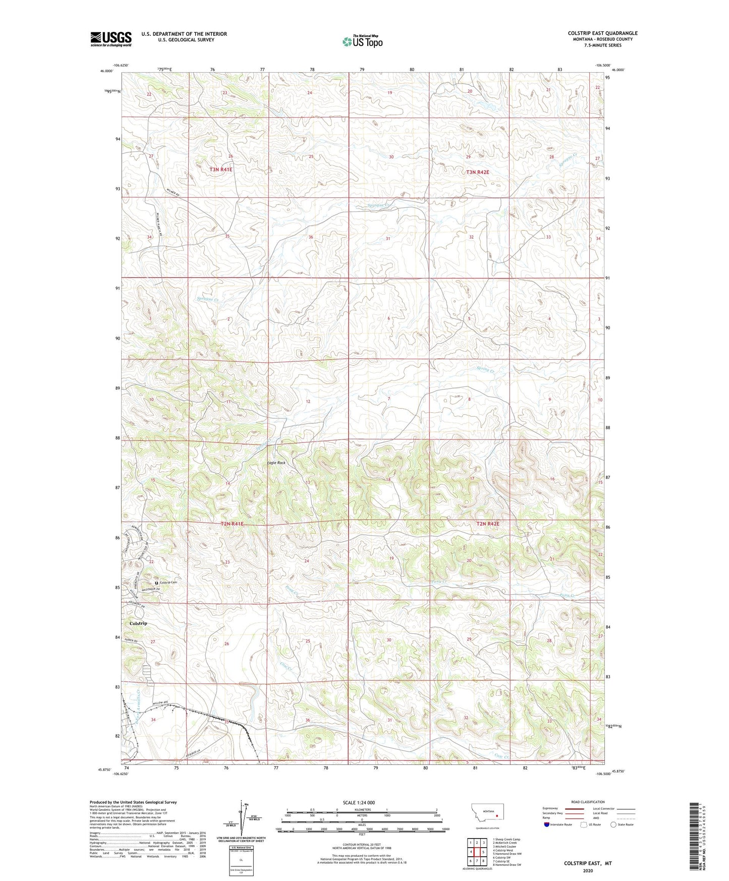
2024 topographic map quadrangle Colstrip East in the state of Montana. Scale: 1:24000. Based on the newly updated USGS 7.5' US Topo map series, this map is in the following counties: Rosebud. The map contains contour data, water features, and other items you are used to seeing on USGS maps, but also has updated roads and other features. This is the next generation of topographic maps. Printed on high-quality waterproof paper with UV fade-resistant inks.
Quads adjacent to this one:
West: Colstrip West
Northwest: Sheep Creek Camp
North: McKerlich Creek
Northeast: Mitchell Coulee
East: Hammond Draw NW
Southeast: Hammond Draw SW
South: Colstrip SE
Southwest: Colstrip SW
This map covers the same area as the classic USGS quad with code o45106h5.
Contains the following named places: 02N41E01DBBA01 Well, 02N41E02DBBA01 Well, 02N41E08ACCD01 Well, 02N41E12CCAD01 Well, 02N41E24CAAA01 Well, 02N41E24CAAB01 Well, 02N41E34BADC01 Well, 02N41E35CCAD01 Well, 02N41E35DABD01 Well, 02N41E35DABD02 Well, 02N42E04DACA01 Well, 02N42E06CBCD01 Well, 02N42E20CDAD01 Well, 02N42E31CAAA01 Well, 02N42E31DDDD01 Well, 02N42E34DDAD01 Well, 02S41E24CAAA01 Well, 03N41E34BCAB01 Well, 03N41E35CBAA01 Well, 03N42E32C___01 Well, Big Timber Park, Colstrip, Colstrip Cemetery, Court Park, Eagle Rock, Hopsonville, Hopsonville Post Office, Obert Rye Park, Piedmont Park, Pony Creek School, Prospector Park, Rosebud Division, South Park, Stillwater Park, Sunnyside School