MyTopo
Mitchell Coulee Montana US Topo Map
Couldn't load pickup availability
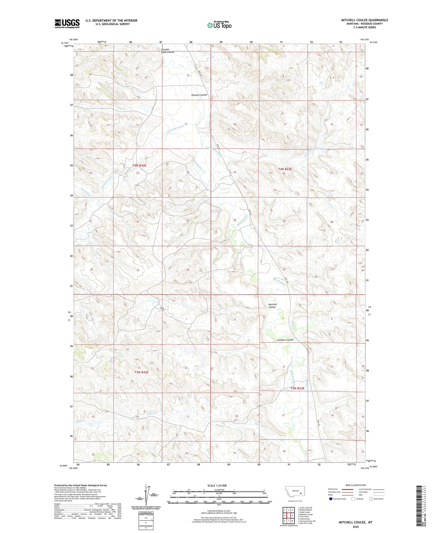
2024 topographic map quadrangle Mitchell Coulee in the state of Montana. Scale: 1:24000. Based on the newly updated USGS 7.5' US Topo map series, this map is in the following counties: Rosebud. The map contains contour data, water features, and other items you are used to seeing on USGS maps, but also has updated roads and other features. This is the next generation of topographic maps. Printed on high-quality waterproof paper with UV fade-resistant inks.
Quads adjacent to this one:
West: McKerlich Creek
Northwest: Smith Creek NE
North: Rosebud Buttes
Northeast: Indian Creek
East: Crain Place
Southeast: John Hen Creek
South: Hammond Draw NW
Southwest: Colstrip East
This map covers the same area as the classic USGS quad with code o46106a4.
Contains the following named places: 03N42E01ADAB01 Well, 03N43E05DDC_01 Well, 03N43E08DCAD01 Well, 03N43E09BCDA01 Well, 03N43E09BDCB01 Well, 03N43E20A___01 Well, 04N42E12A___01 Well, 04N42E12CADB01 Well, 04N42E13D___01 Well, 04N43E07DDBB01 Well, 04N43E30DBAC01 Well, 04N43E31AABB01 Well, Basinski Post Office, Chicken Coop Coulee, Cottonwood Creek, Dry Creek, Eagle Creek, East Cottonwood Creek, Goodman Creek, Graham Coulee, Howard Coulee, Mitchell Coulee, Philbrick Number 3 Dam, Sabra, Sabra Post Office, Sabra School, Sand Number 1 Dam, Sawmill Creek, Udee Creek, Vassaus Number 5 Dam