MyTopo
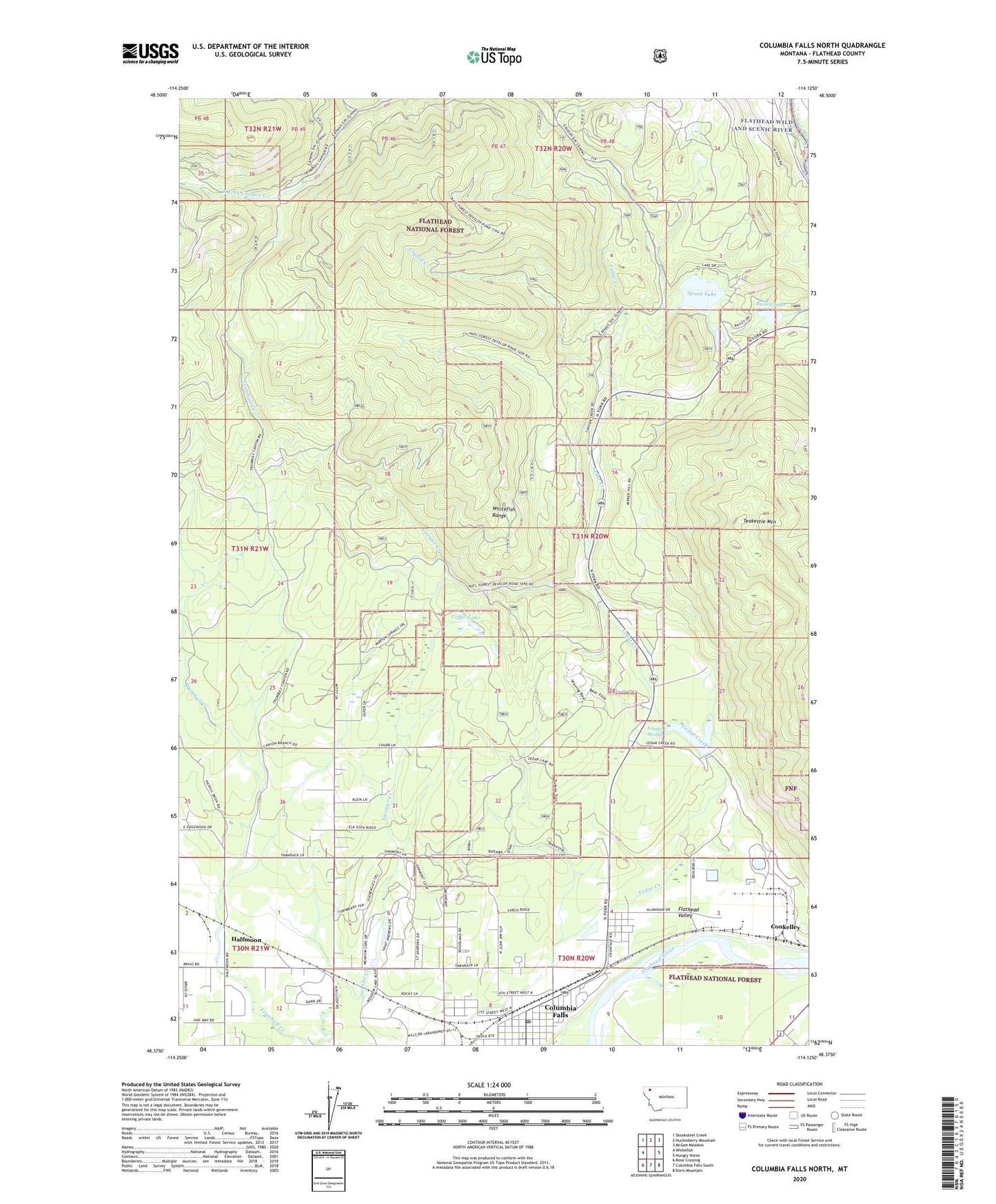
Columbia Falls North Montana US Topo Map
Couldn't load pickup availability
Also explore the Columbia Falls North Forest Service Topo of this same quad for updated USFS data
2024 topographic map quadrangle Columbia Falls North in the state of Montana. Scale: 1:24000. Based on the newly updated USGS 7.5' US Topo map series, this map is in the following counties: Flathead. The map contains contour data, water features, and other items you are used to seeing on USGS maps, but also has updated roads and other features. This is the next generation of topographic maps. Printed on high-quality waterproof paper with UV fade-resistant inks.
Quads adjacent to this one:
West: Whitefish
Northwest: Skookoleel Creek
North: Huckleberry Mountain
Northeast: McGee Meadow
East: Hungry Horse
Southeast: Doris Mountain
South: Columbia Falls South
Southwest: Rose Crossing
This map covers the same area as the classic USGS quad with code o48114d2.
Contains the following named places: 30N20W02CB__01 Well, 30N20W03DA__01 Well, 30N20W03DDDA01 Well, 30N20W03DDDA02 Well, 30N20W05CD__01 Well, 30N20W06CB__01 Well, 30N20W07DA__01 Well, 30N20W08CA__01 Well, 30N20W08DAD_01 Well, 30N20W09CBCB01 Well, 30N21W11AA__01 Well, 31N20W31CCBA01 Well, 31N21W25AD__01 Well, 59912, Bailey Lake, Cedar Creek, Cedar Creek Dam, Cedar Lake, Columbia Falls, Columbia Falls Post Office, Columbia Falls United Methodist Church, Conkelley, Country Estates Mobile Home Park, Crystal Creek, Glacier Christian School, Glacier View Ranger District Ranger Office, Half Moon, Half Moon Mobile Home Park, Halfmoon, Meadow Lake Golf Course, Ninemile Lookout Tower, Schafer Springs, Seventh Day Adventist Church, South Fork Canyon Creek, Spoon Lake