MyTopo
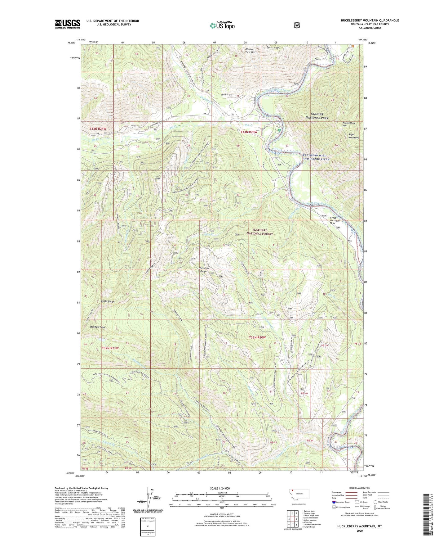
Huckleberry Mountain Montana US Topo Map
Couldn't load pickup availability
Also explore the Huckleberry Mountain Forest Service Topo of this same quad for updated USFS data
2024 topographic map quadrangle Huckleberry Mountain in the state of Montana. Scale: 1:24000. Based on the newly updated USGS 7.5' US Topo map series, this map is in the following counties: Flathead. The map contains contour data, water features, and other items you are used to seeing on USGS maps, but also has updated roads and other features. This is the next generation of topographic maps. Printed on high-quality waterproof paper with UV fade-resistant inks.
Quads adjacent to this one:
West: Skookoleel Creek
Northwest: Cyclone Lake
North: Demers Ridge
Northeast: Camas Ridge West
East: McGee Meadow
Southeast: Hungry Horse
South: Columbia Falls North
Southwest: Whitefish
This map covers the same area as the classic USGS quad with code o48114e2.
Contains the following named places: Big Creek, Big Creek Campground, Big Creek Work Center, Canyon Creek, Deep Creek, Depuy Creek, Dry Creek, Great Northern Flats, Great Northern Flats use site, Hell Roaring Creek, Huckleberry Mountain, Kimmerly Creek, Langford Creek, Lookout Creek, McGinnis Creek, Standard Peak, Steamer Oakes, Upper Big Creek Campground, Vogt Creek