MyTopo
McGee Meadow Montana US Topo Map
Couldn't load pickup availability
Also explore the McGee Meadow Forest Service Topo of this same quad for updated USFS data
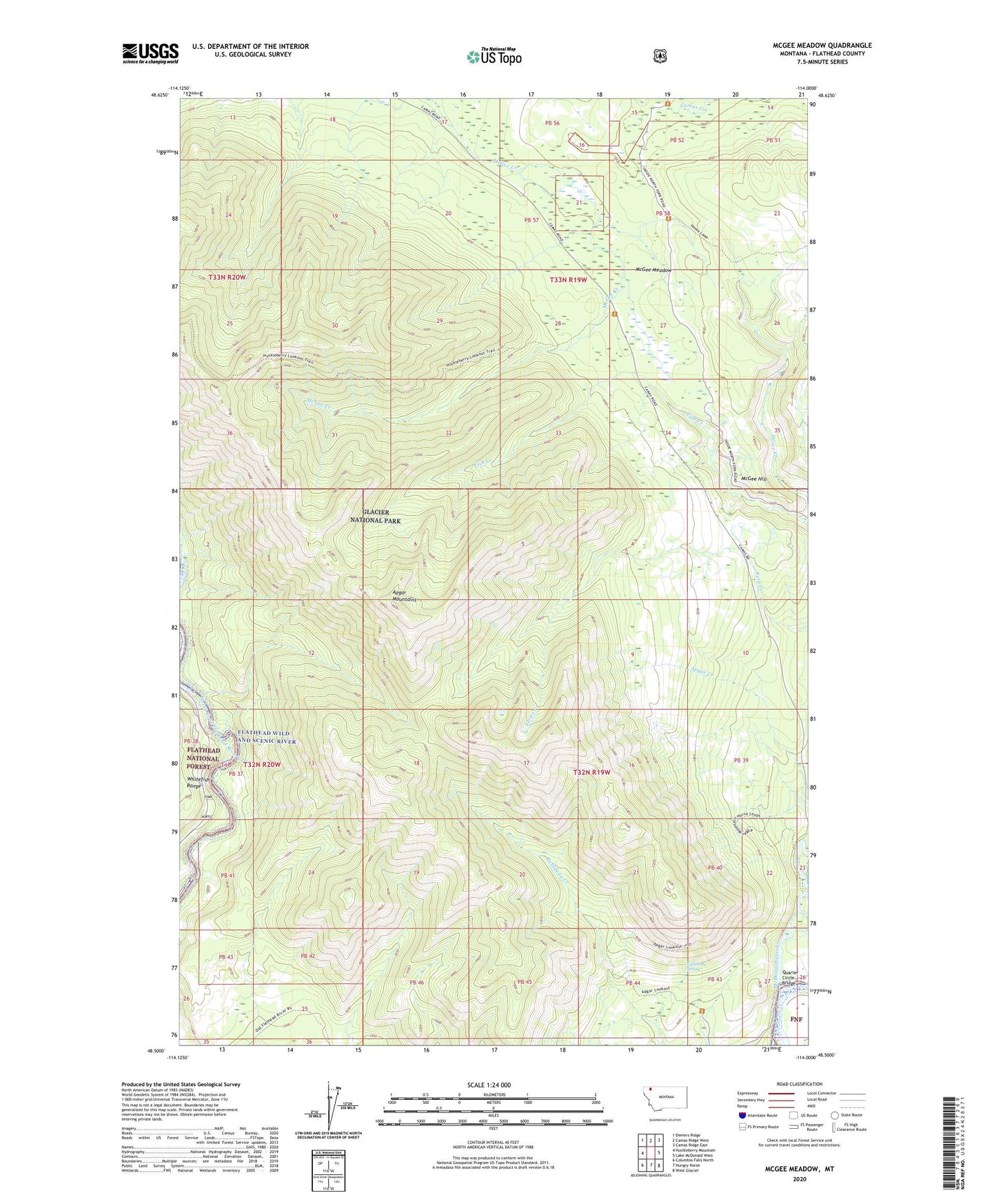
2024 topographic map quadrangle McGee Meadow in the state of Montana. Scale: 1:24000. Based on the newly updated USGS 7.5' US Topo map series, this map is in the following counties: Flathead. The map contains contour data, water features, and other items you are used to seeing on USGS maps, but also has updated roads and other features. This is the next generation of topographic maps. Printed on high-quality waterproof paper with UV fade-resistant inks.
Quads adjacent to this one:
West: Huckleberry Mountain
Northwest: Demers Ridge
North: Camas Ridge West
Northeast: Camas Ridge East
East: Lake McDonald West
Southeast: West Glacier
South: Hungry Horse
Southwest: Columbia Falls North
This map covers the same area as the classic USGS quad with code o48114e1.
Contains the following named places: 32N19W26BCCC01 Well, 32N19W27ADAA01 Well, 32N19W27ADAB01 Well, 32N19W27ADAD01 Well, 32N19W27ADAD02 Well, 32N19W27ADAD03 Well, 32N19W27ADCD01 Well, 32N19W27ADDA01 Well, Apgar Lookout, Apgar Mountains, Camas Creek Overlook, Fool Hen Hill, Howe Creek, Howe Lake Trail, McDonald Creek, McGee Hill, McGee Meadow, McGee Meadow Overlook, Quarter Circle Bridge, Rubideau Spring