MyTopo
Krone Ranch Montana US Topo Map
Couldn't load pickup availability
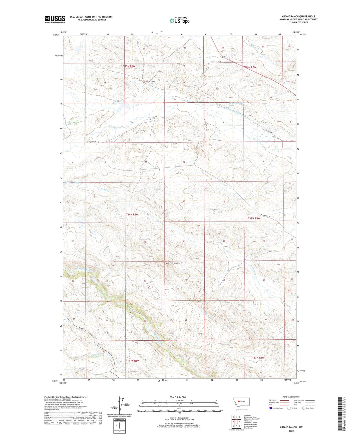
2024 topographic map quadrangle Krone Ranch in the state of Montana. Scale: 1:24000. Based on the newly updated USGS 7.5' US Topo map series, this map is in the following counties: Lewis and Clark. The map contains contour data, water features, and other items you are used to seeing on USGS maps, but also has updated roads and other features. This is the next generation of topographic maps. Printed on high-quality waterproof paper with UV fade-resistant inks.
Quads adjacent to this one:
West: Bean Lake
Northwest: Augusta
North: Gouchnour Ranch
Northeast: Bowmans Corners NW
East: Bowmans Corners
Southeast: Comb Rock
South: Johnson Mountain
Southwest: Blowout Mountain
This map covers the same area as the classic USGS quad with code o47112c3.
Contains the following named places: 18N05W06ABDB01 Spring, Bean Embody Ditch, Bean Ranch, Bernier Ranch, Flat Creek Church, Gillette Creek, Gobblers Knob, Hogan Post Office, Hogan School, Krone Ranch, La Chapelle Place, Lower Ellis Place, Soap Creek Dam, Soap Creek Reservoir, Upper Ellis Place