MyTopo
Fairview SW Montana US Topo Map
Couldn't load pickup availability
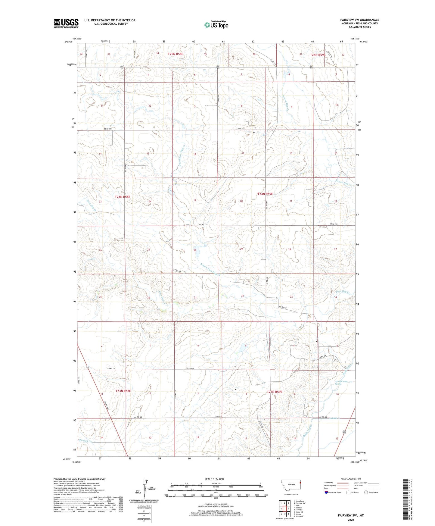
2024 topographic map quadrangle Fairview SW in the state of Montana. Scale: 1:24000. Based on the newly updated USGS 7.5' US Topo map series, this map is in the following counties: Richland. The map contains contour data, water features, and other items you are used to seeing on USGS maps, but also has updated roads and other features. This is the next generation of topographic maps. Printed on high-quality waterproof paper with UV fade-resistant inks.
Quads adjacent to this one:
West: Brorson
Northwest: Sioux Pass
North: Fairview NW
Northeast: Dore
East: Fairview
Southeast: Sidney NE
South: Sidney
Southwest: Crane NE
This map covers the same area as the classic USGS quad with code o47104g2.
Contains the following named places: 23N59E03CAD_01 Well, 23N59E08CDDB01 Well, 23N59E08DD__01 Well, 23N59E10BD__01 Spring, 23N59E15AB__01 Well, 23N59E15DB__01 Well, 23N59E15DB__02 Well, 23N59E15DB__03 Well, 24N58E12DDAC01 Well, 24N59E17ACDA01 Well, 24N59E33DBCD01 Well, B Henderson Dam, Linde Dam, Muriel Post Office, North Fork First Hay Creek, Steinreisser Number 10 Dam