MyTopo
Larson School Montana US Topo Map
Couldn't load pickup availability
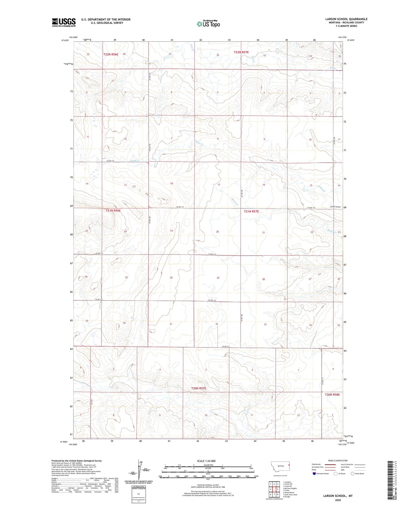
2024 topographic map quadrangle Larson School in the state of Montana. Scale: 1:24000. Based on the newly updated USGS 7.5' US Topo map series, this map is in the following counties: Richland. The map contains contour data, water features, and other items you are used to seeing on USGS maps, but also has updated roads and other features. This is the next generation of topographic maps. Printed on high-quality waterproof paper with UV fade-resistant inks.
Quads adjacent to this one:
West: McCone Heights
Northwest: Lambert
North: Crane NW
Northeast: Crane NE
East: Crane
Southeast: Savage
South: Knife River Mine
Southwest: Allard Ranch
This map covers the same area as the classic USGS quad with code o47104e4.
Contains the following named places: 21N56E24BADC01 Well, 21N56E26BAAC01 Well, 21N57E16DCCB01 Well, 21N57E19AAAA01 Well, 21N57E35CB__01 Well, Dunlap Dam, Gettysburg School, Larson School, Lyle Dam