MyTopo
Brorson Montana US Topo Map
Couldn't load pickup availability
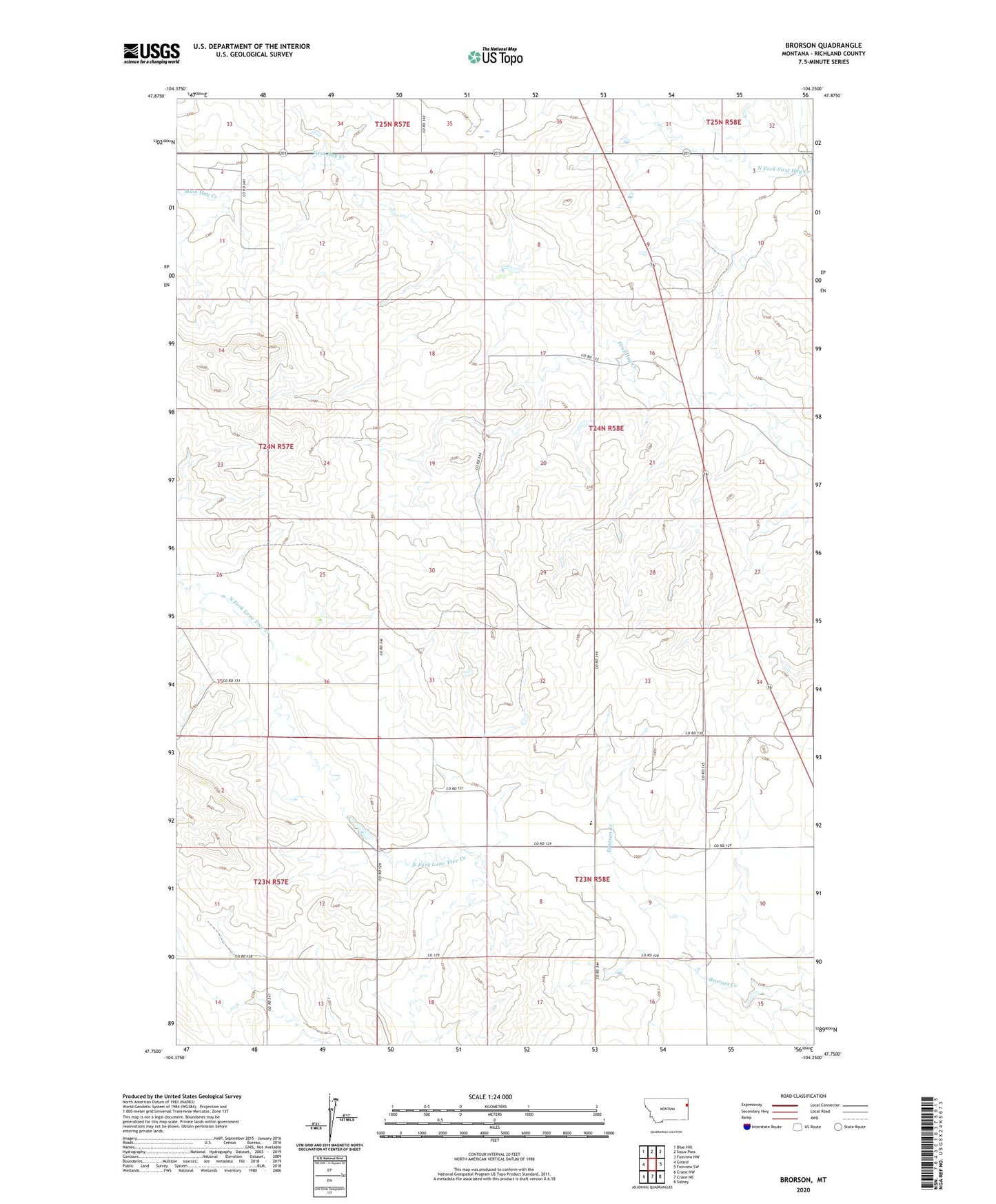
2024 topographic map quadrangle Brorson in the state of Montana. Scale: 1:24000. Based on the newly updated USGS 7.5' US Topo map series, this map is in the following counties: Richland. The map contains contour data, water features, and other items you are used to seeing on USGS maps, but also has updated roads and other features. This is the next generation of topographic maps. Printed on high-quality waterproof paper with UV fade-resistant inks.
Quads adjacent to this one:
West: Girard
Northwest: Blue Hill
North: Sioux Pass
Northeast: Fairview NW
East: Fairview SW
Southeast: Sidney
South: Crane NE
Southwest: Crane NW
This map covers the same area as the classic USGS quad with code o47104g3.
Contains the following named places: 23N50E06DBDD01 Well, 23N57E11CADA01 Well, 23N57E14ADAD01 Well, 23N58E08BABB01 Well, 23N58E08BABC01 Well, 23N58E34DCCD01 Well, 24N58E08BABA01 Well, 24N58E15ACCB01 Well, Albin Dam, Brorson, Brorson Church, Brorson Oil Field, Brorson Post Office, Brorson School, Coon Dam, Four Corners, Main Hay Creek, Midway Community Center