MyTopo
Crazyman Coulee Montana US Topo Map
Couldn't load pickup availability
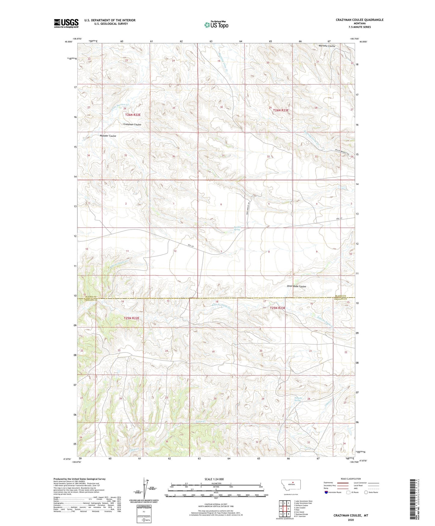
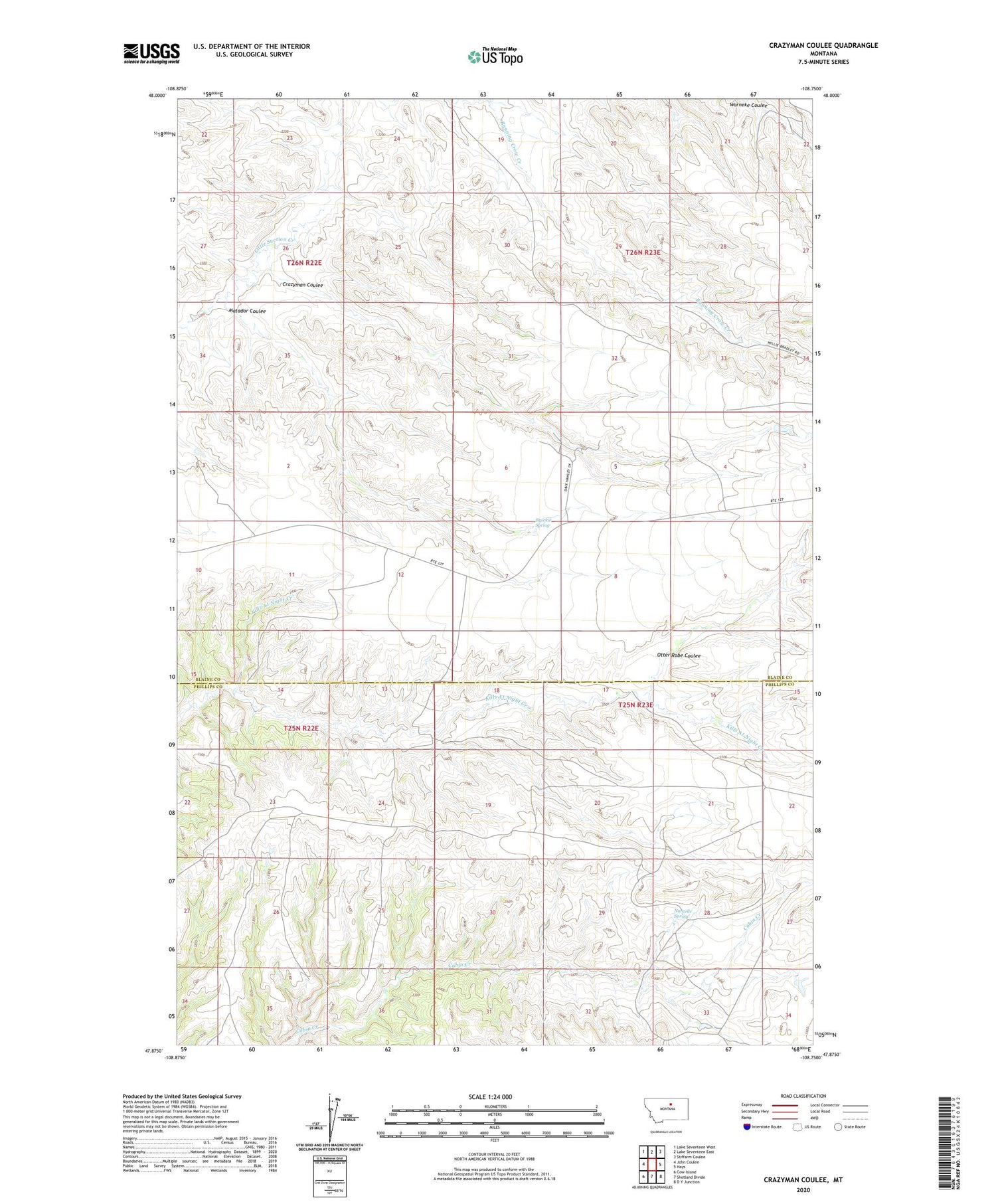
2020 topographic map quadrangle Crazyman Coulee in the state of Montana. Scale: 1:24000. Based on the newly updated USGS 7.5' US Topo map series, this map is in the following counties: Blaine, Phillips. The map contains contour data, water features, and other items you are used to seeing on USGS maps, but also has updated roads and other features. This is the next generation of topographic maps. Printed on high-quality waterproof paper with UV fade-resistant inks.
Quads adjacent to this one:
West: John Coulee
Northwest: Lake Seventeen West
North: Lake Seventeen East
Northeast: Stiffarm Coulee
East: Hays
Southeast: D Y Junction
South: Shetland Divide
Southwest: Cow Island
Contains the following named places: 25N22E12CABA01 Well, 25N22E13DDB_01 Well, 25N23E21CAAC01 Well, 26N23E30DBD_01 Well, Brockie Spring, Crazyman Coulee, Matador Coulee, Nantelle Post Office, Nantelle Spring, Otter Robe Coulee