MyTopo
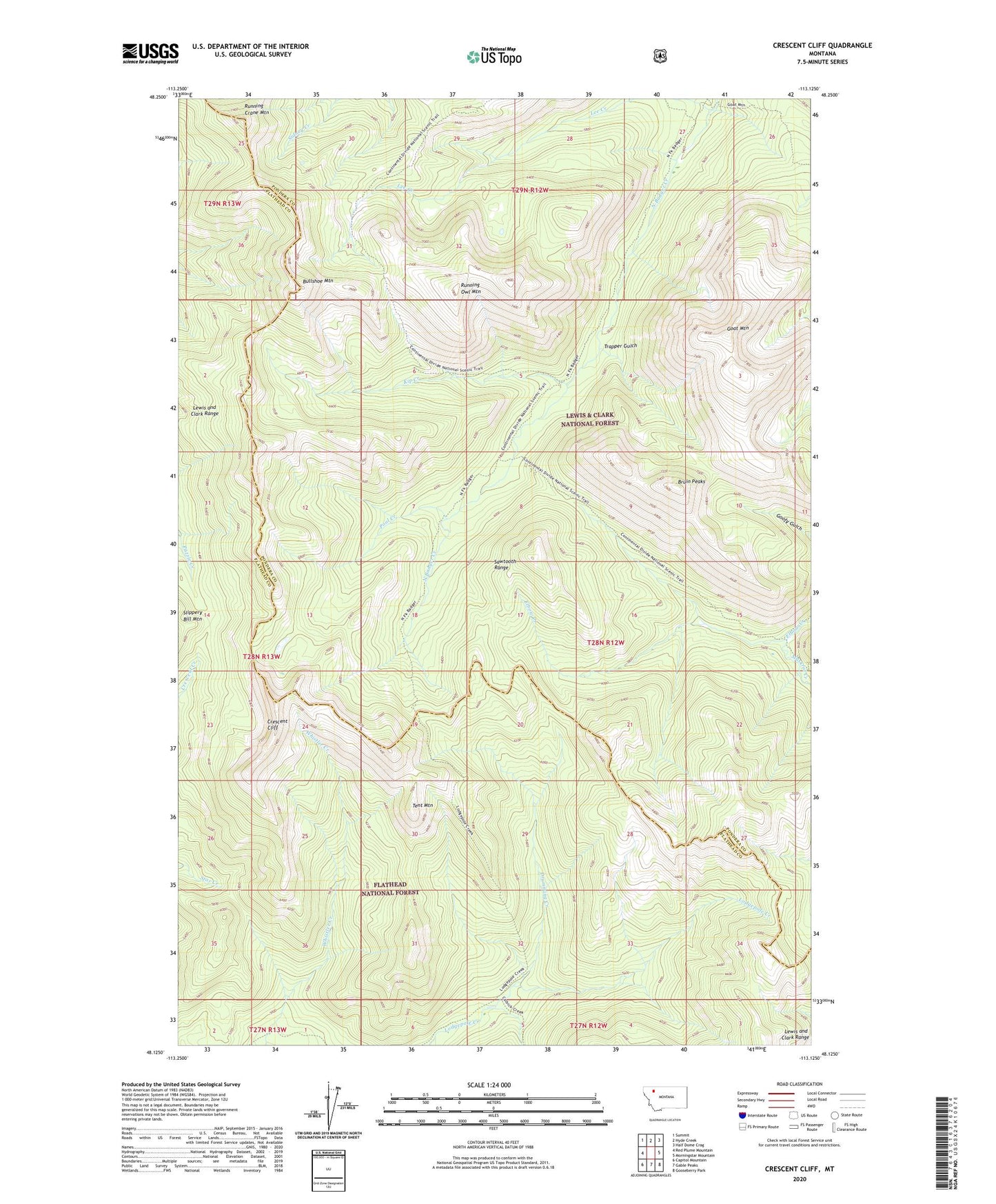
Crescent Cliff Montana US Topo Map
Couldn't load pickup availability
Also explore the Crescent Cliff Forest Service Topo of this same quad for updated USFS data
2024 topographic map quadrangle Crescent Cliff in the state of Montana. Scale: 1:24000. Based on the newly updated USGS 7.5' US Topo map series, this map is in the following counties: Pondera, Flathead. The map contains contour data, water features, and other items you are used to seeing on USGS maps, but also has updated roads and other features. This is the next generation of topographic maps. Printed on high-quality waterproof paper with UV fade-resistant inks.
Quads adjacent to this one:
West: Red Plume Mountain
Northwest: Summit
North: Hyde Creek
Northeast: Half Dome Crag
East: Morningstar Mountain
Southeast: Gooseberry Park
South: Gable Peaks
Southwest: Capitol Mountain
This map covers the same area as the classic USGS quad with code o48113b2.
Contains the following named places: Big Lodge Mountain, Bruin Peaks, Bullshoe Mountain, Calbick Creek Trail, Crescent Cliff, Drumming Creek, Goat Mountain, Kip Creek, Lee Creek, Lodgepole Creek Trail, Lost Horse Camp, Muskrat Creek, North Badger-Elbow Creek Trail, Pool Creek, Running Crane Mountain, Running Owl Mountain, Tent Mountain, Trapper Gulch