MyTopo
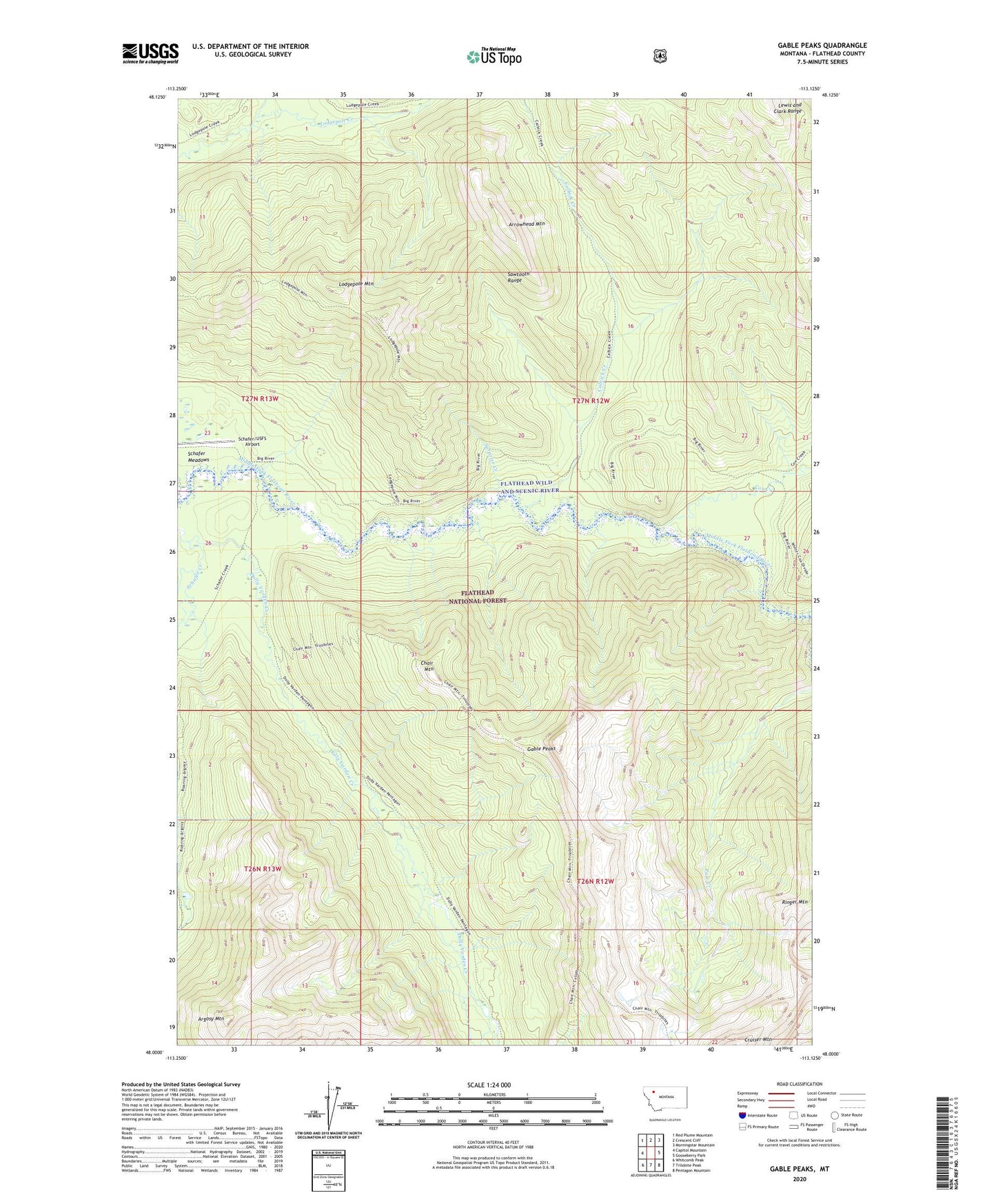
Gable Peaks Montana US Topo Map
Couldn't load pickup availability
Also explore the Gable Peaks Forest Service Topo of this same quad for updated USFS data
2024 topographic map quadrangle Gable Peaks in the state of Montana. Scale: 1:24000. Based on the newly updated USGS 7.5' US Topo map series, this map is in the following counties: Flathead. The map contains contour data, water features, and other items you are used to seeing on USGS maps, but also has updated roads and other features. This is the next generation of topographic maps. Printed on high-quality waterproof paper with UV fade-resistant inks.
Quads adjacent to this one:
West: Capitol Mountain
Northwest: Red Plume Mountain
North: Crescent Cliff
Northeast: Morningstar Mountain
East: Gooseberry Park
Southeast: Pentagon Mountain
South: Trilobite Peak
Southwest: Whitcomb Peak
This map covers the same area as the classic USGS quad with code o48113a2.
Contains the following named places: Argosy Mountain, Arrowhead Mountain, Calbick Creek, Chair Mountain, Cox Creek, Dolly Varden Creek, Gable Peaks, Lodgepole Mountain, Ringer Mountain, Schafer Meadows, Schafer Ranger Station, Schafer/USFS Airport, Surprise Creek, Whistler Creek