MyTopo
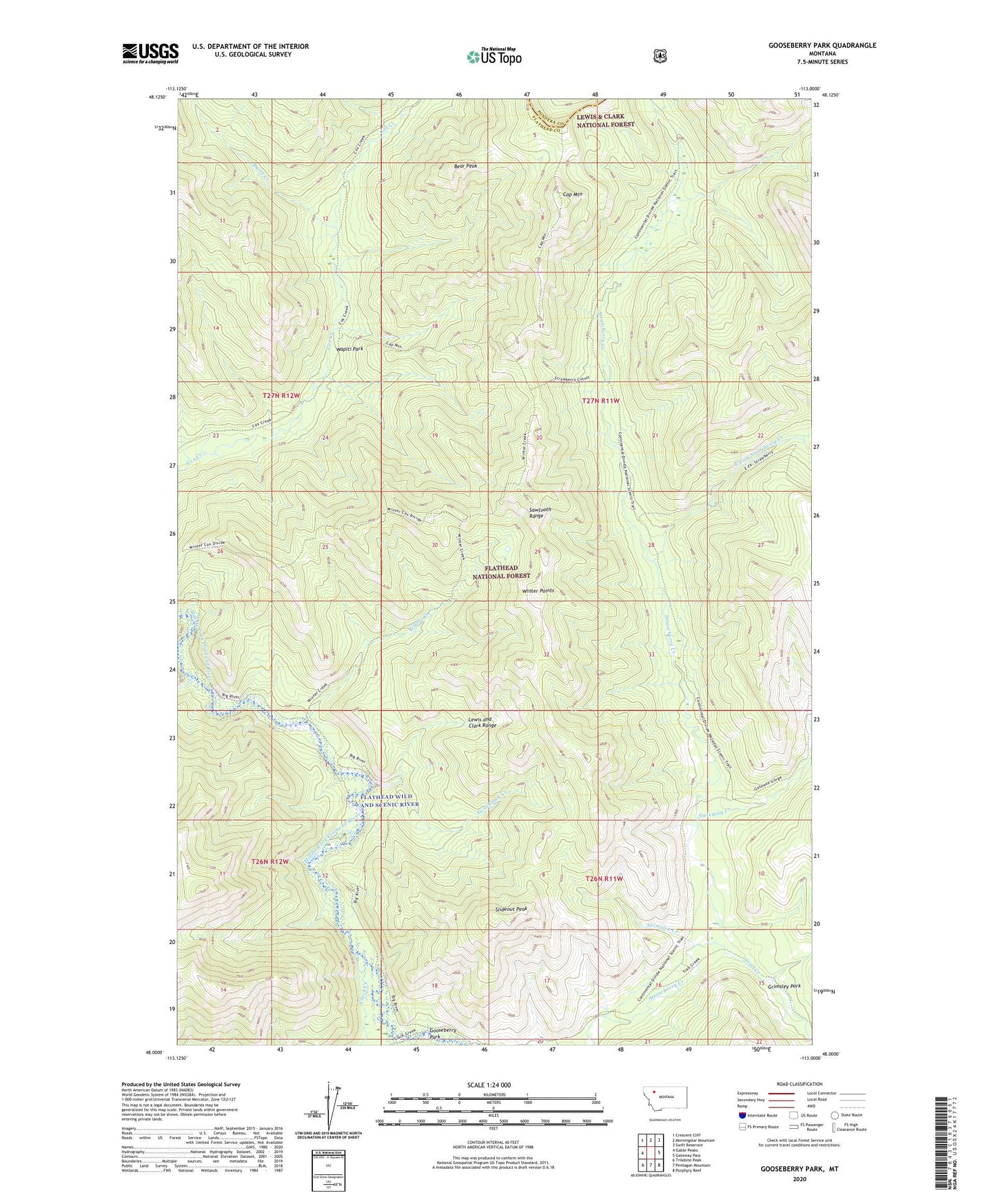
Gooseberry Park Montana US Topo Map
Couldn't load pickup availability
Also explore the Gooseberry Park Forest Service Topo of this same quad for updated USFS data
2024 topographic map quadrangle Gooseberry Park in the state of Montana. Scale: 1:24000. Based on the newly updated USGS 7.5' US Topo map series, this map is in the following counties: Flathead, Pondera. The map contains contour data, water features, and other items you are used to seeing on USGS maps, but also has updated roads and other features. This is the next generation of topographic maps. Printed on high-quality waterproof paper with UV fade-resistant inks.
Quads adjacent to this one:
West: Gable Peaks
Northwest: Crescent Cliff
North: Morningstar Mountain
Northeast: Swift Reservoir
East: Gateway Pass
Southeast: Porphyry Reef
South: Pentagon Mountain
Southwest: Trilobite Peak
Contains the following named places: Bear Peak, Burnt Creek, Cap Mountain, Clack Creek, East Fork Strawberry Creek, Gateway Creek, Gooseberry Park, Grimsley Creek, Grimsley Park, Pale Creek, Slideout Peak, Switchback Creek, Trail Creek, Wapiti Park, Winter Creek, Winter Points