MyTopo
Cross S School Montana US Topo Map
Couldn't load pickup availability
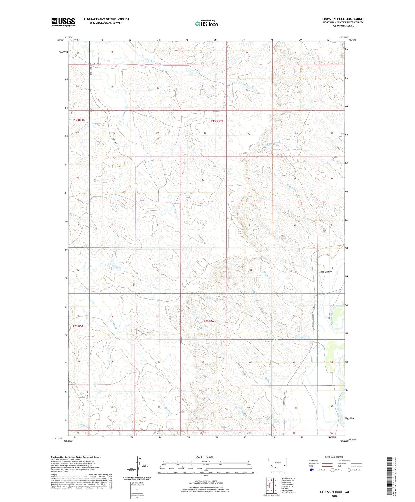
2024 topographic map quadrangle Cross S School in the state of Montana. Scale: 1:24000. Based on the newly updated USGS 7.5' US Topo map series, this map is in the following counties: Powder River. The map contains contour data, water features, and other items you are used to seeing on USGS maps, but also has updated roads and other features. This is the next generation of topographic maps. Printed on high-quality waterproof paper with UV fade-resistant inks.
Quads adjacent to this one:
West: Johnnie Creek
Northwest: Witcher Reservoir
North: Rattlesnake Hill
Northeast: Snake Butte
East: Oliphant Butte
Southeast: Deer Creek Buttes
South: Hawkey Creek
Southwest: T Creek
This map covers the same area as the classic USGS quad with code o45105f3.
Contains the following named places: 01S52E18CBDC01 Well, 01S52E19BBBB01 Well, 01S52E22BCCA01 Well, 01S52E32ABCA01 Well, 01S52E32DDAA01 Well, 02S52E04BABB01 Well, 02S52E06ABBA01 Well, 02S52E19BADC01 Well, 02S52E23DDA_01 Well, 02S52E23DDA_02 Well, 02S52E24CCBB01 Well, 02S52E24CCBB02 Well, 07S52E10DACC01 Well, Buffalo Creek, Crooked Creek, Cross S School, Deep Coulee, East Fork Cross S Creek, Jurica Number 1 Dam, Landa Number 2 Dam, Mud Creek, Road Creek, Short Creek, Spear Number 1 Dam