MyTopo
T Creek Montana US Topo Map
Couldn't load pickup availability
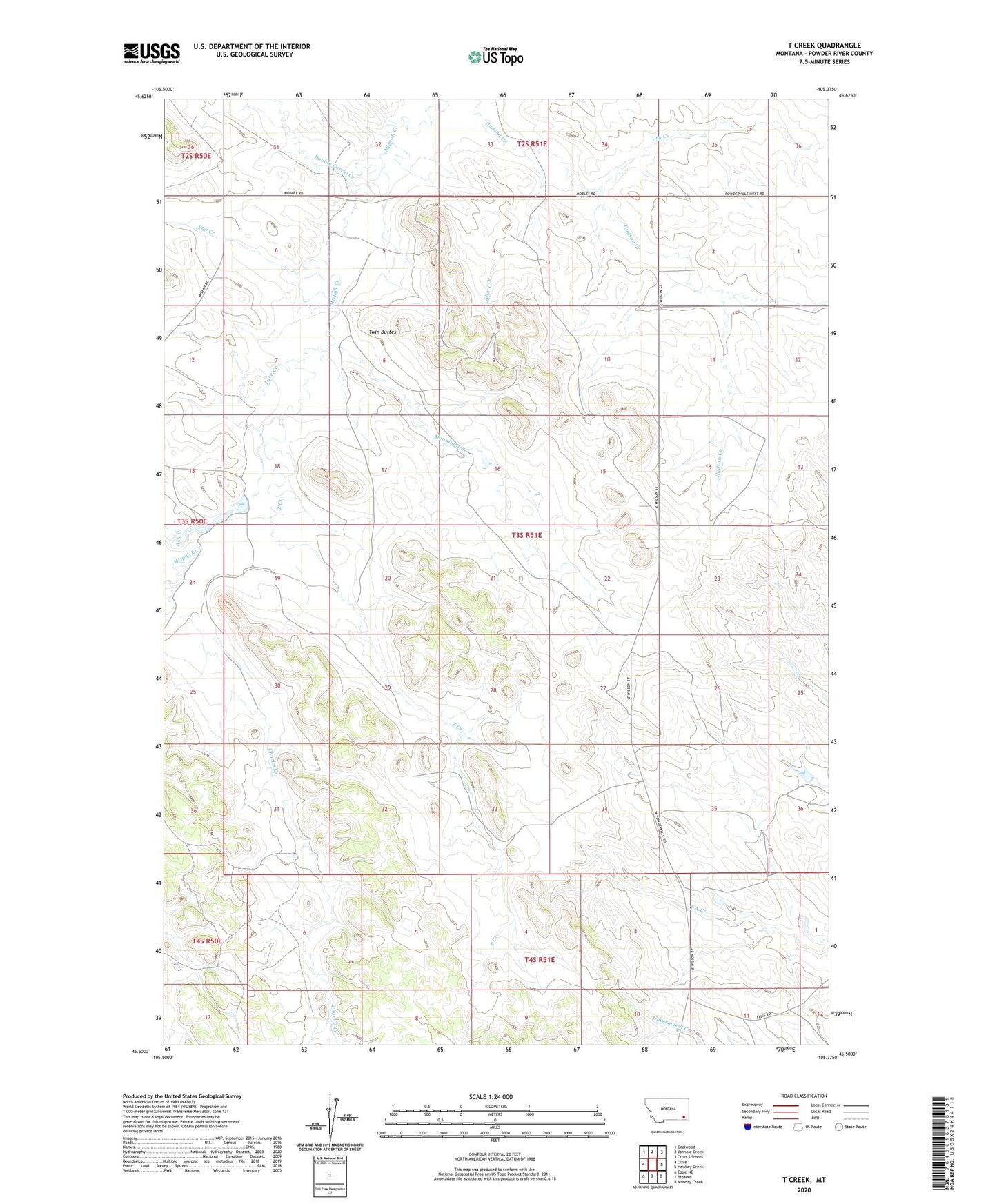
2024 topographic map quadrangle T Creek in the state of Montana. Scale: 1:24000. Based on the newly updated USGS 7.5' US Topo map series, this map is in the following counties: Powder River. The map contains contour data, water features, and other items you are used to seeing on USGS maps, but also has updated roads and other features. This is the next generation of topographic maps. Printed on high-quality waterproof paper with UV fade-resistant inks.
Quads adjacent to this one:
West: Olive
Northwest: Coalwood
North: Johnnie Creek
Northeast: Cross S School
East: Hawkey Creek
Southeast: Monday Creek
South: Broadus
Southwest: Epsie NE
This map covers the same area as the classic USGS quad with code o45105e4.
Contains the following named places: 02S51E31CAAD01 Well, 03S50E12AACB01 Well, 03S50E24DDAB01 Well, 03S51E03CADB01 Well, 03S51E04BBDA01 Well, 03S51E08DCAB01 Well, 03S51E10AABB01 Well, 03S51E14ABAB01 Well, 03S51E17CDCB01 Well, 03S51E21ADCB01 Well, 03S51E26BDCA01 Well, 03S51E30DABB01 Well, 03S51E34BADD01 Well, 03S51E34CBC_01 Well, 03S52E31CAAC01 Well, Ash Creek, Broadus Division, Charles Creek, Double Corral Creek, Dry Creek, Emmons Number 1 Dam, Flat Creek, Lake Creek, Moonlight Creek, Short Creek, T Creek, Twin Buttes