MyTopo
Hawkey Creek Montana US Topo Map
Couldn't load pickup availability
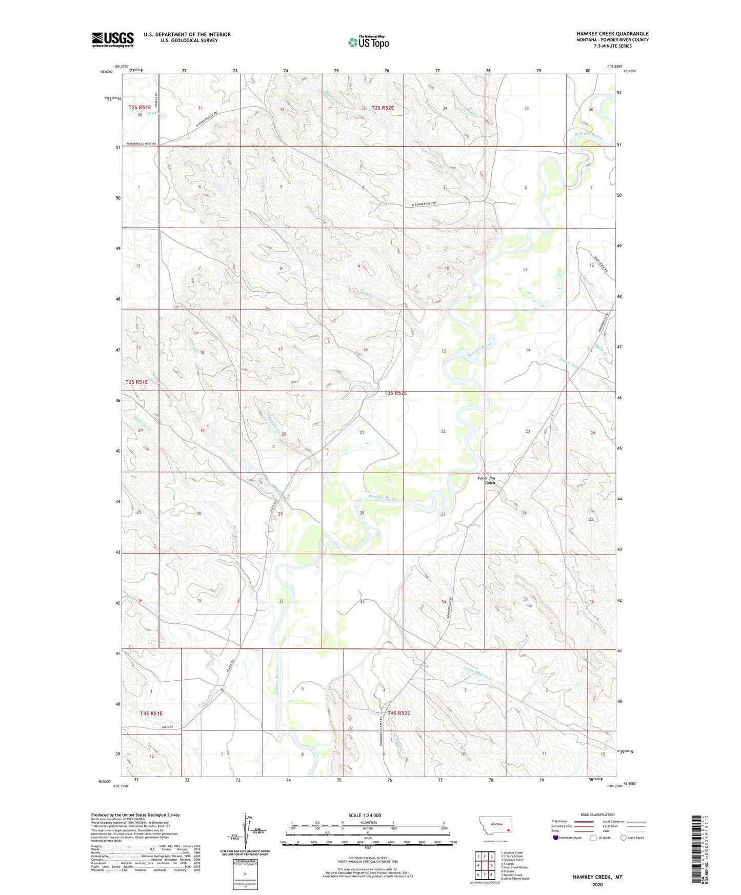
2024 topographic map quadrangle Hawkey Creek in the state of Montana. Scale: 1:24000. Based on the newly updated USGS 7.5' US Topo map series, this map is in the following counties: Powder River. The map contains contour data, water features, and other items you are used to seeing on USGS maps, but also has updated roads and other features. This is the next generation of topographic maps. Printed on high-quality waterproof paper with UV fade-resistant inks.
Quads adjacent to this one:
West: T Creek
Northwest: Johnnie Creek
North: Cross S School
Northeast: Oliphant Butte
East: Deer Creek Buttes
Southeast: Little Pilgrim Butte
South: Monday Creek
Southwest: Broadus
This map covers the same area as the classic USGS quad with code o45105e3.
Contains the following named places: 02S52E34BDCA01 Well, 03S51E25AAA_01 Well, 03S52E12BAA_01 Well, 03S52E23BBD_01 Well, 03S52E24BDA_01 Well, 03S52E27AD__01 Well, 03S52E27CADA01 Well, 04S52E05CABA01 Well, 04S52E10BADC01 Well, Butte Creek, Deer Creek, Gring Creek, Hawkey Creek, Hay Creek, Little Pilgrim Creek, Magpie Creek, Pilgrim Creek, Poker Jim Creek, Poker Jim Gulch, Road Creek, Rough Creek, T A Creek, Watters Number 1 Dam, Wild Cat Creek, Wolf Creek