MyTopo
Weldon Montana US Topo Map
Couldn't load pickup availability
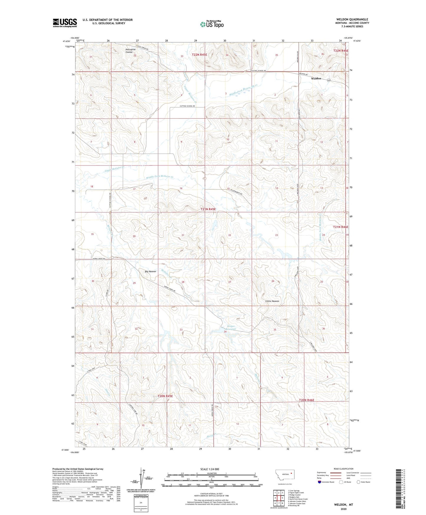
2024 topographic map quadrangle Weldon in the state of Montana. Scale: 1:24000. Based on the newly updated USGS 7.5' US Topo map series, this map is in the following counties: McCone. The map contains contour data, water features, and other items you are used to seeing on USGS maps, but also has updated roads and other features. This is the next generation of topographic maps. Printed on high-quality waterproof paper with UV fade-resistant inks.
Quads adjacent to this one:
West: Rodgers Hall
Northwest: Crow Springs
North: Figure Eight Creek
Northeast: Pedigo Coulee
East: North Fork Horse Creek
Southeast: Brockway NE
South: Johnson Coulee East
Southwest: Johnson Coulee West
This map covers the same area as the classic USGS quad with code o47105e8.
Contains the following named places: 20N45E11BADC01 Well, 21N45E02DADB01 Well, 21N45E05CDBB01 Well, 21N45E05DDCA01 Well, 21N45E08CACC01 Well, 21N45E08CACC02 Well, 21N45E08DBCC01 Well, 21N45E10BACC01 Well, 21N45E12BB__01 Well, 21N45E15BAAA01 Well, 21N45E16ABBC01 Well, 21N45E16ADAB01 Well, 21N45E16ADAB02 Well, 21N45E16DDDB01 Well, 21N45E17ADCA01 Well, 21N45E17ADCA02 Well, 21N45E18CAAB01 Well, 21N45E20DCCD01 Well, 21N45E23DCBB01 Well, 21N45E26DAAD01 Well, 21N45E29DABC01 Well, 21N45E34BBDA01 Well, 21N45E34BBDA02 Well, 21N45E35BCDC01 Well, 21N45E36ACCC01 Well, 21N47E12CCCC01 Well, 22N45E33DCBB01 Well, 22N45E33DCBD01 Well, 22N45E33DCBD02 Well, Big Heaven, Dreyer Brothers Incorporated Number 2 Dam, Dreyer Dam, Dreyer Number 2 Dam, Dreyer Reservoir, Dreyer Reservoir Number 2, Fillenworth Number 3 Dam, Fillenworth Reservoir Number 1 Dam, Fillerworth Number 2 Dam, Little Heaven, Middle Fork McGuire Creek, Upper McGuire Creek, Weldon, Weldon Post Office, Weldon School