MyTopo
Ryegate West Montana US Topo Map
Couldn't load pickup availability
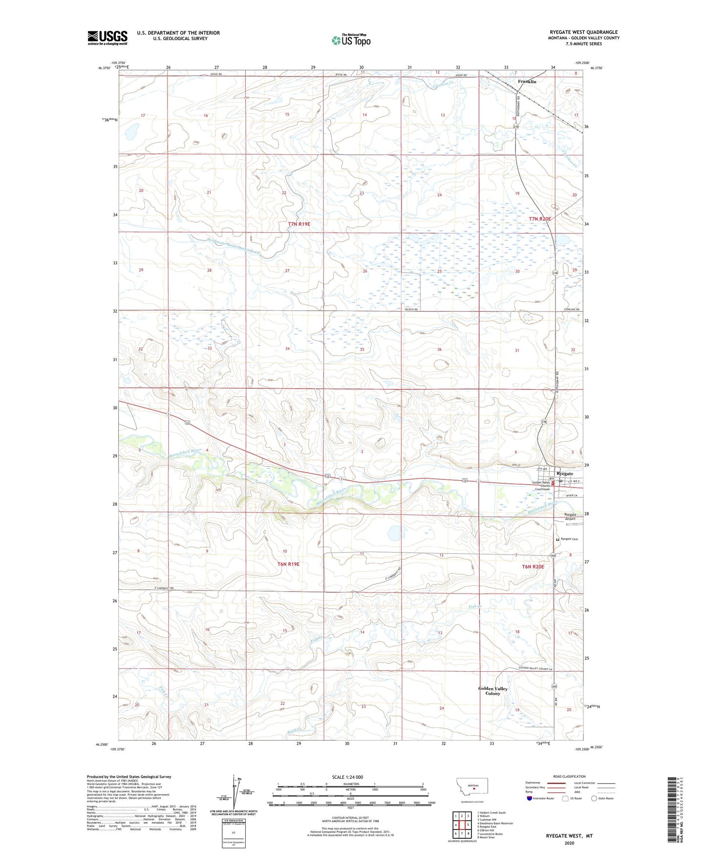
2024 topographic map quadrangle Ryegate West in the state of Montana. Scale: 1:24000. Based on the newly updated USGS 7.5' US Topo map series, this map is in the following counties: Golden Valley. The map contains contour data, water features, and other items you are used to seeing on USGS maps, but also has updated roads and other features. This is the next generation of topographic maps. Printed on high-quality waterproof paper with UV fade-resistant inks.
Quads adjacent to this one:
West: Deadmans Basin Reservoir
Northwest: Halbert Creek South
North: Wallum
Northeast: Cushman NW
East: Ryegate East
Southeast: Mount Sinai
South: Locomotive Butte
This map covers the same area as the classic USGS quad with code o46109c3.
Contains the following named places: 06N19E01BCCC01 Well, 06N19E23BCDB01 Well, 06N20E05DA__01 Well, 06N20E06ADA_01 Well, 06N20E20BBC_01 Well, 59074, Deadmans Basin Outlet Canal, Dodgeton Post Office, Dodgetown, Farmers Elevator, First Golden Valley Baptist Church, Franklin, Franklin Post Office, Franklin School, Golden Valley Colony, Golden Valley Colony Census Designated Place, Golden Valley Colony School, Golden Valley County Sheriff's Office, Golden Valley Court House, Rock Creek, Rocky Mountain Elevator, Ryegate, Ryegate Airport, Ryegate Ambulance, Ryegate Assembly of God Church, Ryegate Cemetery, Ryegate City Park, Ryegate Methodist Church, Ryegate Police Department, Ryegate Post Office, Ryegate Public Schools, Ryegate Volunteer Fire Department, Saint Mathias Catholic Church, Schaffs RV Court, Stella Number 1 Dam, Town of Ryegate