MyTopo
Custer Montana US Topo Map
Couldn't load pickup availability
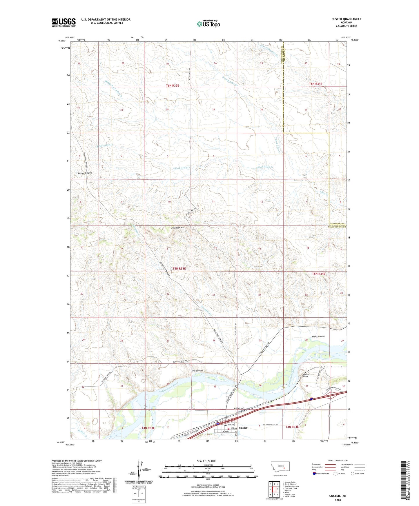
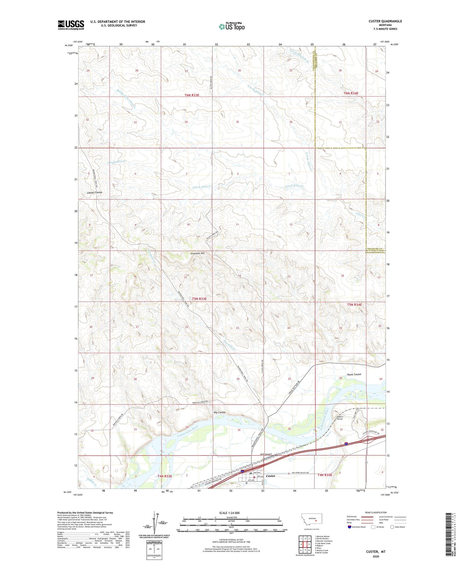
2020 topographic map quadrangle Custer in the state of Montana. Scale: 1:24000. Based on the newly updated USGS 7.5' US Topo map series, this map is in the following counties: Yellowstone, Treasure. The map contains contour data, water features, and other items you are used to seeing on USGS maps, but also has updated roads and other features. This is the next generation of topographic maps. Printed on high-quality waterproof paper with UV fade-resistant inks.
Quads adjacent to this one:
West: Coal Bank Creek
Northwest: Mexican Buttes
North: Devils Kitchen
Northeast: Rancher Cemetery
East: Bighorn
Southeast: Marsh Coulee
South: Mission Creek
Southwest: Waco
Contains the following named places: 05N33E10BBAC01 Well, 05N33E26D___01 Well, 05N33E32ABCB01 Well, 05N33E32DABC01 Well, Big Coulee, Bighorn Tunnel, Buffalo Creek, Custer, Custer Census Designated Place, Custer Post Office, Custer Volunteer Fire Department, Fivemile Creek, Fivemile Hill, Hawk Coulee, Larsen Ranch, Middle Fork Allen Creek, North Fork Allen Creek, Ruff Airport, South Fork Allen Creek