MyTopo
Bighorn Montana US Topo Map
Couldn't load pickup availability
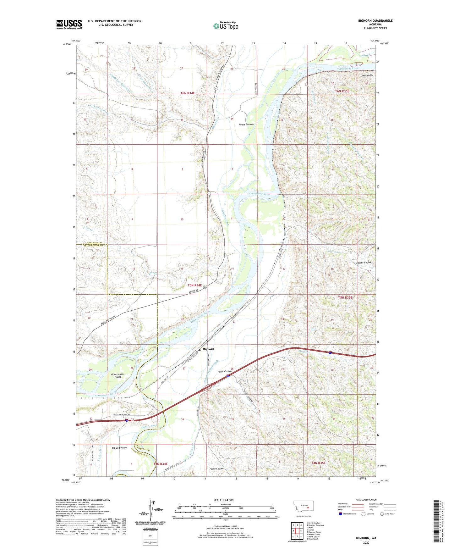
2024 topographic map quadrangle Bighorn in the state of Montana. Scale: 1:24000. Based on the newly updated USGS 7.5' US Topo map series, this map is in the following counties: Treasure, Yellowstone. The map contains contour data, water features, and other items you are used to seeing on USGS maps, but also has updated roads and other features. This is the next generation of topographic maps. Printed on high-quality waterproof paper with UV fade-resistant inks.
Quads adjacent to this one:
West: Custer
Northwest: Devils Kitchen
North: Rancher Cemetery
Northeast: Myers
East: Eldering Ranch
Southeast: Hope Ranch
South: Marsh Coulee
Southwest: Mission Creek
This map covers the same area as the classic USGS quad with code o46107b4.
Contains the following named places: 05N34E05DBDA01 Well, 05N34E11B___01 Well, 05N34E21BACD01 Well, 05N34E27A___01 Well, 06N34E25C___01 Well, Allen Creek, Ash Coulee School, Big Horn, Big Horn Post, Big Horn School, Bighorn, Bighorn Post Office, Bighorn River, Bighorn Tullock Ditch, Cutoff Creek, East Fork Fortysix Creek, Edwards Creek, Edwards Creek School, Etchetah, Etchetah Post Office, Etchetah School, Fort Benton, Fort Cass, Fort Manuel Lisa, Fort Pease, Fortysix Creek, Government Island, Guys Bluffs, Jacobs Coulee, Kurtzville, Manuel Lisa Fishing Access Site, Middle Fork Edwards Creek, North Fork Edwards Creek, Pasco Coulee, Petes Coulee, Rancher, South Fork Edwards Creek, Tullock Creek, Unknown Creek, West Fork Fortysix Creek