MyTopo
Devils Kitchen Montana US Topo Map
Couldn't load pickup availability
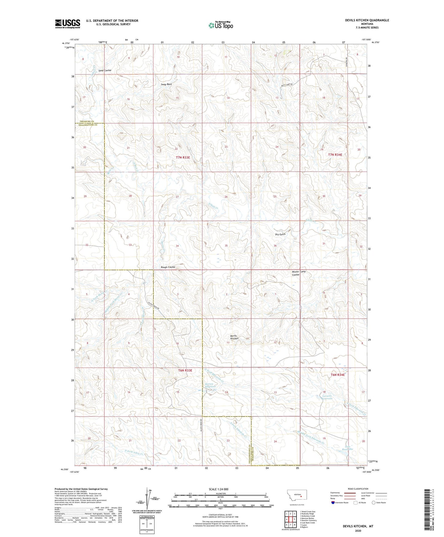
2024 topographic map quadrangle Devils Kitchen in the state of Montana. Scale: 1:24000. Based on the newly updated USGS 7.5' US Topo map series, this map is in the following counties: Treasure, Yellowstone. The map contains contour data, water features, and other items you are used to seeing on USGS maps, but also has updated roads and other features. This is the next generation of topographic maps. Printed on high-quality waterproof paper with UV fade-resistant inks.
Quads adjacent to this one:
West: Mexican Buttes
Northwest: Weed Creek East
North: Ruskosky Ridge
Northeast: McKonkey Creek
East: Rancher Cemetery
Southeast: Bighorn
South: Custer
Southwest: Coal Bank Creek
This map covers the same area as the classic USGS quad with code o46107c5.
Contains the following named places: 07N25E24DAC_01 Well, Butte Creek, Devils Kitchen, Dry Gulch, Horse Creek, Horse Creek Crossing Well, Horton Reservoir, Larsens Reservoir, Middle Fork Horse Creek, North Fork Horse Creek, Rock Butte Well, Rough Coulee, Sand Coulee, South Fork Horse Creek, Sway Back, Teds Reservoir, Winter Camp Coulee, Yellow Haired Custer Dam