MyTopo
Brush Lake Montana US Topo Map
Couldn't load pickup availability
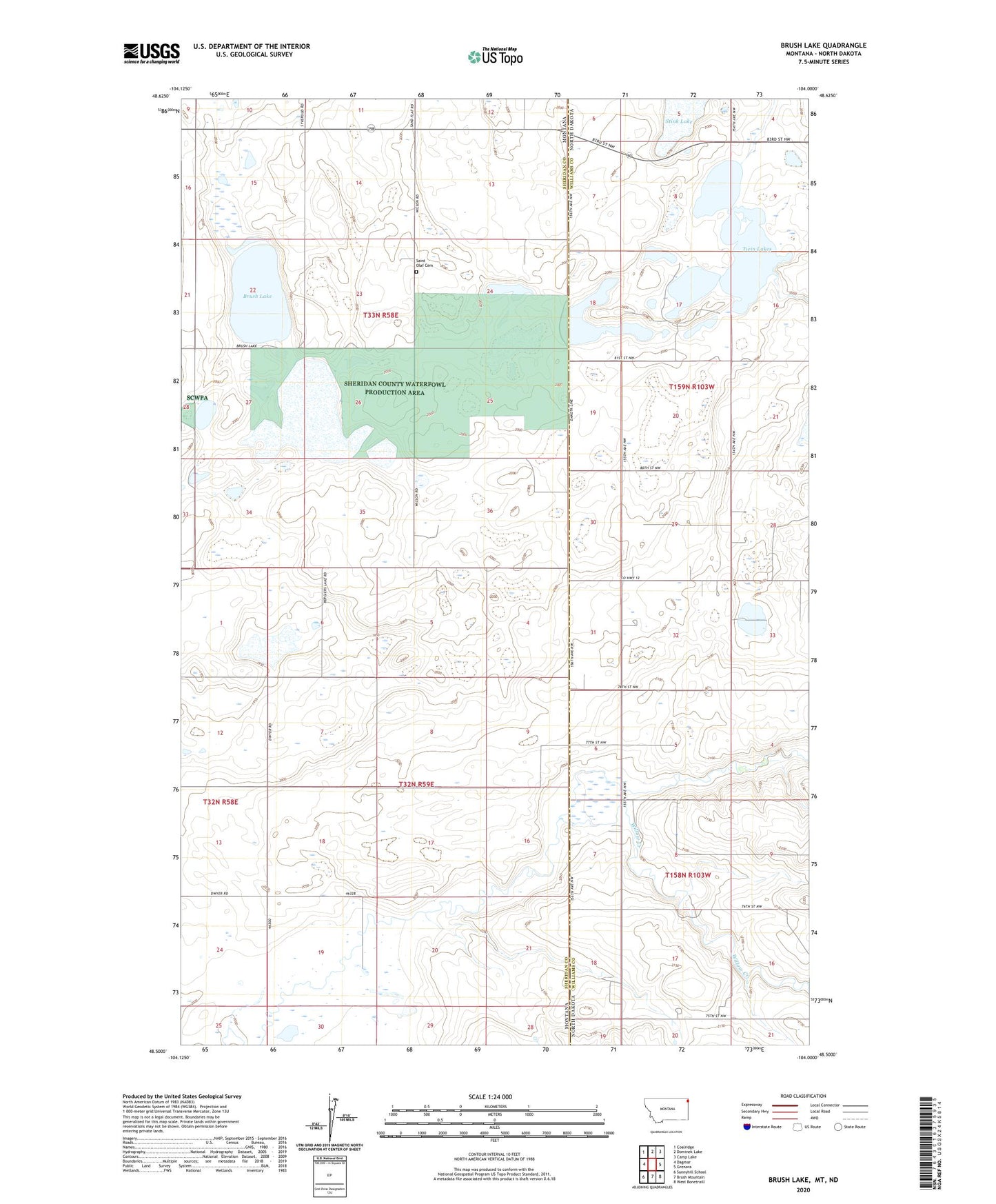
2024 topographic map quadrangle Brush Lake in the states of Montana, North Dakota. Scale: 1:24000. Based on the newly updated USGS 7.5' US Topo map series, this map is in the following counties: Sheridan, Williams. The map contains contour data, water features, and other items you are used to seeing on USGS maps, but also has updated roads and other features. This is the next generation of topographic maps. Printed on high-quality waterproof paper with UV fade-resistant inks.
Quads adjacent to this one:
West: Dagmar
Northwest: Coalridge
North: Dominek Lake
Northeast: Camp Lake
East: Grenora
Southeast: West Bonetraill
South: Brush Mountain
Southwest: Sunnyhill School
Contains the following named places: 32N58E12DDCC01 Well, 32N58E13DDDB01 Well, 32N59E04DDDD01 Well, 32N59E08BCBA01 Well, 32N59E09DDBC01 Well, 32N59E19BDBC01 Well, 32N59E29A___01 Well, 33N58E23AADB01 Well, 33N58E23CBCA01 Well, 33N58E23CBCA02 Well, 33N58E23CCAA01 Well, 33N58E24AAAA01 Well, 33N58E25AAAA01 Well, 33N58E25AAAA02 Well, 33N58E25AAAA03 Well, 33N58E36AADD01 Well, 33N58E36DDDD01 Well, Brush Lake, Brush Lake Resort, Horseshoe Lake, LaFayette School, Liberty School, Saint Olaf Cemetery, Stink Lake, Township of Grenora, Twin Lakes, Willow Creek, Wilson School