MyTopo
Brush Mountain Montana US Topo Map
Couldn't load pickup availability
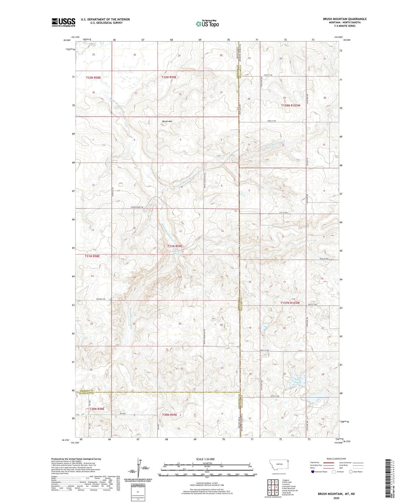
2024 topographic map quadrangle Brush Mountain in the states of Montana, North Dakota. Scale: 1:24000. Based on the newly updated USGS 7.5' US Topo map series, this map is in the following counties: Sheridan, Williams, Roosevelt. The map contains contour data, water features, and other items you are used to seeing on USGS maps, but also has updated roads and other features. This is the next generation of topographic maps. Printed on high-quality waterproof paper with UV fade-resistant inks.
Quads adjacent to this one:
West: Sunnyhill School
Northwest: Dagmar
North: Brush Lake
Northeast: Grenora
East: West Bonetraill
Southeast: Bonetraill SW
South: Bull Butte
Southwest: Brush Mountain SW
Contains the following named places: 31N58E25AADB01 Well, 31N59E06CCCA01 Well, Brush Mountain, Brush Mountain Creek, Calvin Dam, Chase Lake State Game Management Area, Dead Horse Spring, East Fork Brush Mountain Creek, Lincoln School, Scandia Cemetery, Scandia Church, Sueet Slough, View Hill School