MyTopo
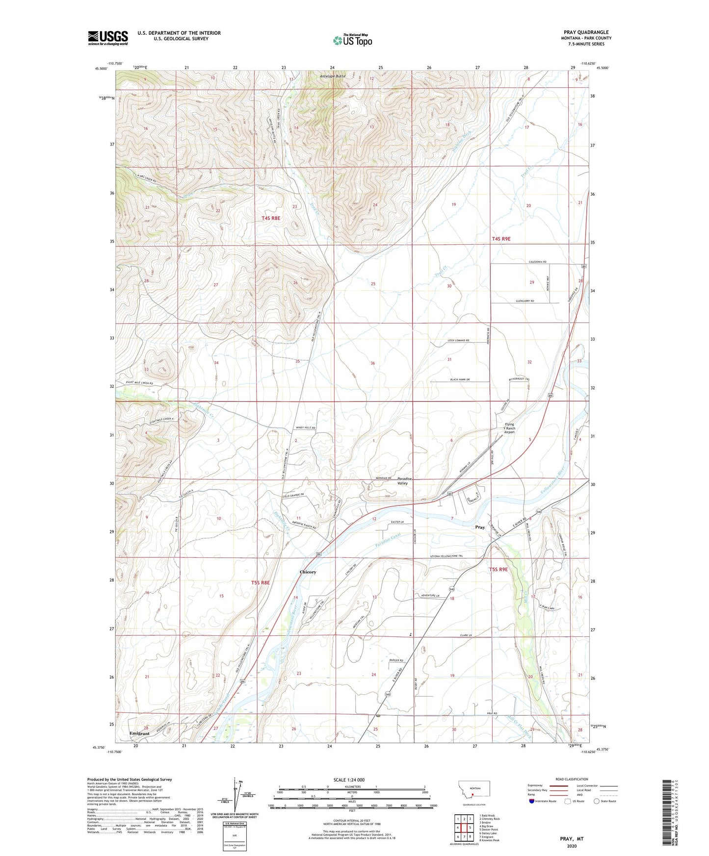
Pray Montana US Topo Map
Couldn't load pickup availability
Also explore the Pray Forest Service Topo of this same quad for updated USFS data
2024 topographic map quadrangle Pray in the state of Montana. Scale: 1:24000. Based on the newly updated USGS 7.5' US Topo map series, this map is in the following counties: Park. The map contains contour data, water features, and other items you are used to seeing on USGS maps, but also has updated roads and other features. This is the next generation of topographic maps. Printed on high-quality waterproof paper with UV fade-resistant inks.
Quads adjacent to this one:
West: Big Draw
Northwest: Bald Knob
North: Chimney Rock
Northeast: Brisbin
East: Dexter Point
Southeast: Knowles Peak
South: Emigrant
Southwest: Dailey Lake
This map covers the same area as the classic USGS quad with code o45110d6.
Contains the following named places: Antelope Butte, Arrowhead School, Briscoe Ditch, Chicory, Chicory Fishing Access Site, Chicory Recreation Area, Chicory Sportsmans Access, Community Church, Dry Creek, Eightmile Creek, Elbow School, Emigant West Recreation Area, Emigrant Census Designated Place, Emigrant West Fishing Access Site, Flying Y Ranch Airport, Grey Owl Fishing Access Site, Grey Owl Recreation Area, Hayden Post Office, Highline Ditch, Mill Creek, Mill Creek Fishing Access Site, Mill Creek Flat School, Nesbit Cemetery, Nesbit School, Paradise Fishing Access Site, Paradise Recreation Area, Pine Creek, Pray, Pray Census Designated Place, Pray Post Office, Pray Siding, Riverside, Riverside Post Office, Yellowstone Edge RV Park