MyTopo
De Borgia North Montana US Topo Map
Couldn't load pickup availability
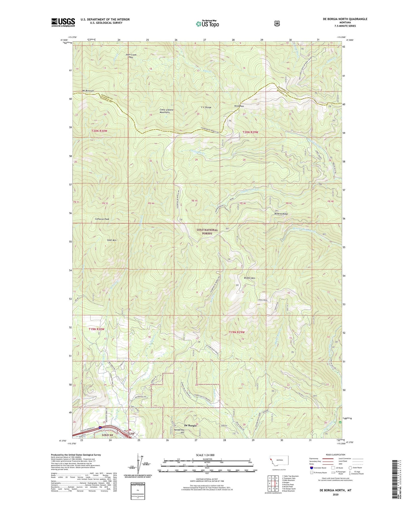
2020 topographic map quadrangle De Borgia North in the state of Montana. Scale: 1:24000. Based on the newly updated USGS 7.5' US Topo map series, this map is in the following counties: Mineral, Sanders. The map contains contour data, water features, and other items you are used to seeing on USGS maps, but also has updated roads and other features. This is the next generation of topographic maps. Printed on high-quality waterproof paper with UV fade-resistant inks.
Quads adjacent to this one:
West: Haugan
Northwest: Table Top Mountain
North: Thompson Falls
Northeast: Eddy Mountain
East: Penrose Peak
Southeast: Boyd Mountain
South: De Borgia South
Southwest: McGee Peak
Contains the following named places: Brooks Mountain, Cabin City Campground, Cameron Peak, Cantonment Jordan, Copper Rock Mine, De Borgia, De Borgia Post Office, DeBorgia School, Deer Creek, East Twin Creek, Goat Mountain, Joan Creek Pass, Knox Pass, Middle Rock Creek, Mineral Ridge, Mount Bushnell, Rock Creek Vista, Rock Island Mine, Texas Mine, Trapper Cabin Creek, True Fissure Mine, Upper West Twin Creek Mine, Valentine Mine, West End Volunteer Fire Department, West Twin Creek Mine, ZIP Code: 59830