MyTopo
De Borgia South Montana US Topo Map
Couldn't load pickup availability
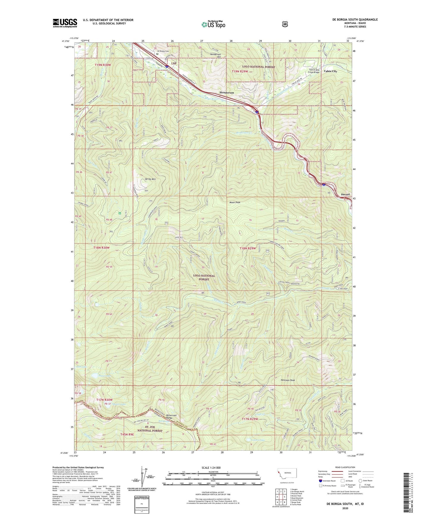
2020 topographic map quadrangle De Borgia South in the states of Montana, Idaho. Scale: 1:24000. Based on the newly updated USGS 7.5' US Topo map series, this map is in the following counties: Mineral, Shoshone. The map contains contour data, water features, and other items you are used to seeing on USGS maps, but also has updated roads and other features. This is the next generation of topographic maps. Printed on high-quality waterproof paper with UV fade-resistant inks.
Quads adjacent to this one:
West: McGee Peak
Northwest: Haugan
North: De Borgia North
Northeast: Penrose Peak
East: Boyd Mountain
Southeast: Torino Peak
South: Berge Peak
Southwest: Conrad Peak
Contains the following named places: Aladdin Mine, Armada, Armada School, Bed Springs, Cabin City, Canyon Creek, Cedar Creek, Coyle Creek, De Borgia Cemetery, De Borgia Census Designated Place, Drexel, Drexel Post Office, Drexel School, East Fork Twelvemile Creek, Fisher Creek, Gold Creek, Goldberg/Tawney Mine, Hazel Lake, Henderson, Henderson Creek, Henderson Hill, Henderson Post Office, Henderson School, Lenora Lake, Mann, Mayo Creek, Moon Peak, New Lanore Mine, New Lenore Mine, Newman Creek, Newman Peak, Rock Creek, Square Lake, Twelve Mile Creek Bridge, Twelvemile Creek, Twin Creek, Unnamed Creek, Up Up Mountain, West End Division, West Twin Creek