MyTopo
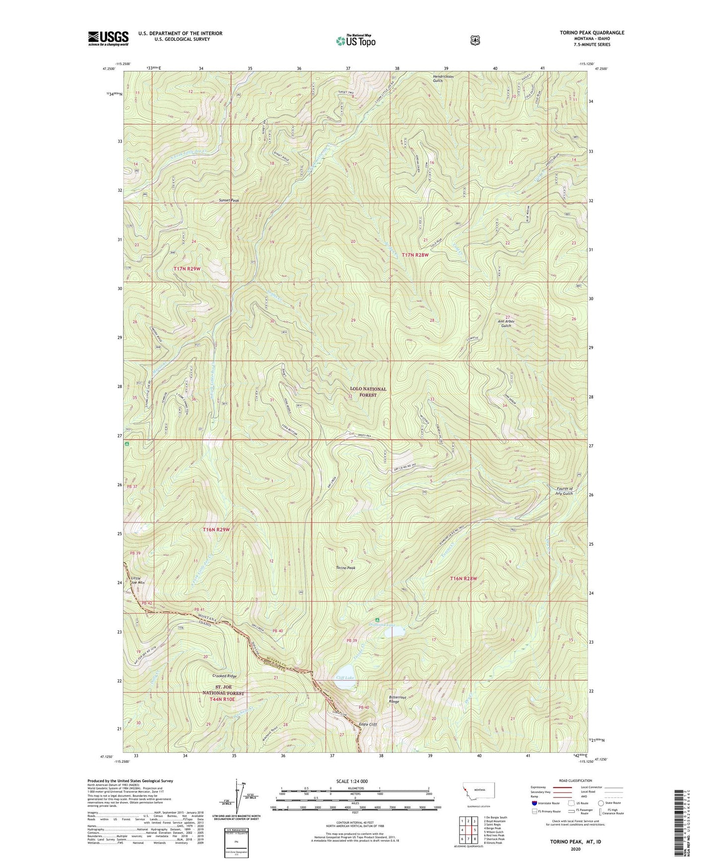
Torino Peak Montana US Topo Map
Couldn't load pickup availability
Also explore the Torino Peak Forest Service Topo of this same quad for updated USFS data
2024 topographic map quadrangle Torino Peak in the states of Montana, Idaho. Scale: 1:24000. Based on the newly updated USGS 7.5' US Topo map series, this map is in the following counties: Mineral, Shoshone. The map contains contour data, water features, and other items you are used to seeing on USGS maps, but also has updated roads and other features. This is the next generation of topographic maps. Printed on high-quality waterproof paper with UV fade-resistant inks.
Quads adjacent to this one:
West: Berge Peak
Northwest: De Borgia South
North: Boyd Mountain
Northeast: Saint Regis
East: Wilson Gulch
Southeast: Illinois Peak
South: Sherlock Peak
Southwest: Red Ives Peak
This map covers the same area as the classic USGS quad with code o47115b2.
Contains the following named places: Cliff Lake, Crooked Ridge, Diamond Lake, Diamond Lake Recreation Site, Eagle Cliff, Fourth of July Gulch, Hendrickson Gulch, Jordan Creek, Little Joe Mountain, Little Joe Slide Point of Interest, Moore Creek, Moore Lake Recreation Site, Sunset Creek, Sunset Peak, Torino Creek, Torino Peak