MyTopo
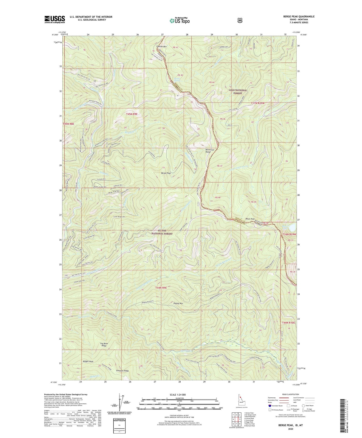
Berge Peak Idaho US Topo Map
Couldn't load pickup availability
Also explore the Berge Peak Forest Service Topo of this same quad for updated USFS data
2024 topographic map quadrangle Berge Peak in the states of Idaho, Montana. Scale: 1:24000. Based on the newly updated USGS 7.5' US Topo map series, this map is in the following counties: Shoshone, Mineral. The map contains contour data, water features, and other items you are used to seeing on USGS maps, but also has updated roads and other features. This is the next generation of topographic maps. Printed on high-quality waterproof paper with UV fade-resistant inks.
Quads adjacent to this one:
West: Conrad Peak
Northwest: McGee Peak
North: De Borgia South
Northeast: Boyd Mountain
East: Torino Peak
Southeast: Sherlock Peak
South: Red Ives Peak
Southwest: Peggy Peak
Contains the following named places: Bear Spring Creek, Berge Creek, Berge Peak, Black Peak, Broadaxe Creek, Dolly Creek, Flattop Mountain, Float Creek, Leg Bone Ridge, Midget Peak, Moore Lake, North Fork Simmons Creek, Pegleg Mountain, Pretty Creek, Spruce Creek, Summit Springs, Three Lakes Creek