MyTopo
Deer Park Montana US Topo Map
Couldn't load pickup availability
Also explore the Deer Park Forest Service Topo of this same quad for updated USFS data
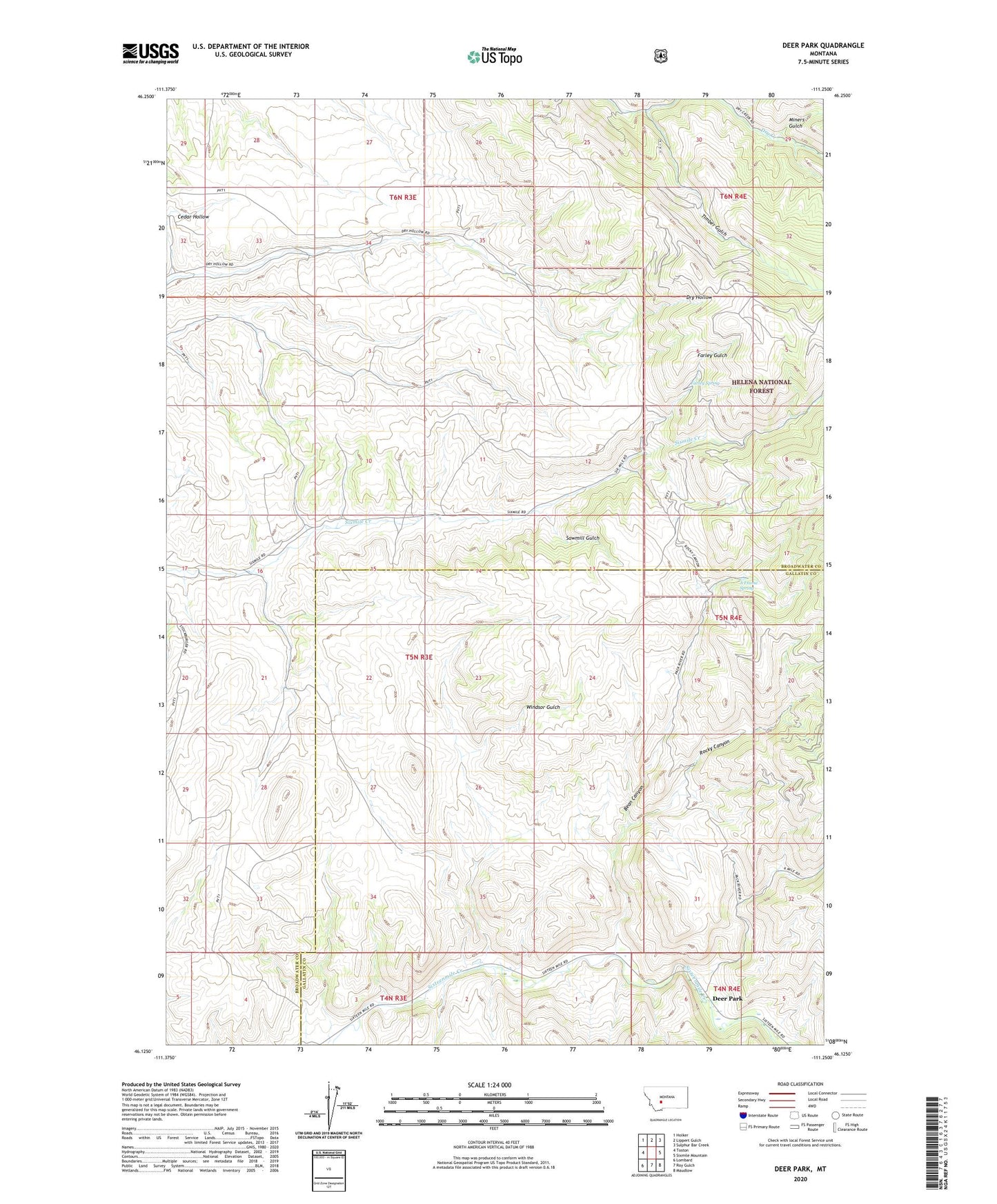
2024 topographic map quadrangle Deer Park in the state of Montana. Scale: 1:24000. Based on the newly updated USGS 7.5' US Topo map series, this map is in the following counties: Broadwater, Gallatin. The map contains contour data, water features, and other items you are used to seeing on USGS maps, but also has updated roads and other features. This is the next generation of topographic maps. Printed on high-quality waterproof paper with UV fade-resistant inks.
Quads adjacent to this one:
West: Toston
Northwest: Holker
North: Lippert Gulch
Northeast: Sulphur Bar Creek
East: Sixmile Mountain
Southeast: Maudlow
South: Roy Gulch
Southwest: Lombard
This map covers the same area as the classic USGS quad with code o46111b3.
Contains the following named places: 06N03E32DD__01 Well, 06N03E34AC__01 Well, A Frame Spring, Bean Canyon, Cedar Hollow, Crane School, Deer Park, Farley Gulch, Farley Spring, Miners Gulch, Rocky Canyon, Sawmill Gulch, Shull, Timber Gulch, Windsor Gulch