MyTopo
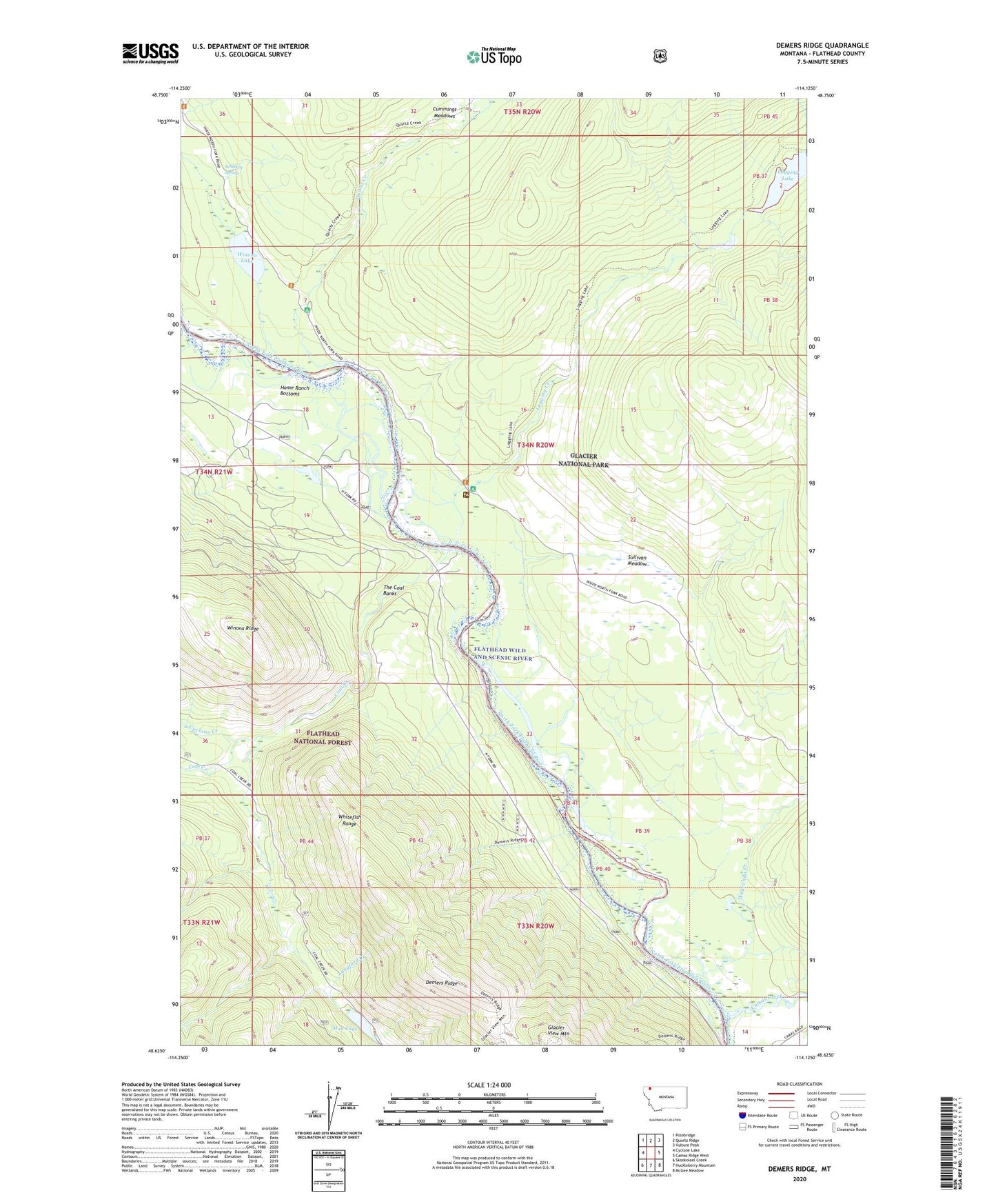
Demers Ridge Montana US Topo Map
Couldn't load pickup availability
Also explore the Demers Ridge Forest Service Topo of this same quad for updated USFS data
2024 topographic map quadrangle Demers Ridge in the state of Montana. Scale: 1:24000. Based on the newly updated USGS 7.5' US Topo map series, this map is in the following counties: Flathead. The map contains contour data, water features, and other items you are used to seeing on USGS maps, but also has updated roads and other features. This is the next generation of topographic maps. Printed on high-quality waterproof paper with UV fade-resistant inks.
Quads adjacent to this one:
West: Cyclone Lake
Northwest: Polebridge
North: Quartz Ridge
Northeast: Vulture Peak
East: Camas Ridge West
Southeast: McGee Meadow
South: Huckleberry Mountain
Southwest: Skookoleel Creek
This map covers the same area as the classic USGS quad with code o48114f2.
Contains the following named places: 34N20W07DBB_01 Well, 34N20W20DDA_01 Well, 34N20W21BCB_01 Well, Adair, Anaconda Creek, Camas Creek, Camas Creek Entrance, Coal Creek, Cummings Meadows, Cyclone Creek, Demers Ridge, Glacier View Mountain, Home Ranch Bottoms, Logging Creek, Logging Creek Campground, Logging Creek Ranger Station, Mud Lake, Quartz Creek, Quartz Creek Campground, Sullivan Meadow, The Coal Banks, Whiskey Spring, Winona Lake