MyTopo
Dry Mountain Montana US Topo Map
Couldn't load pickup availability
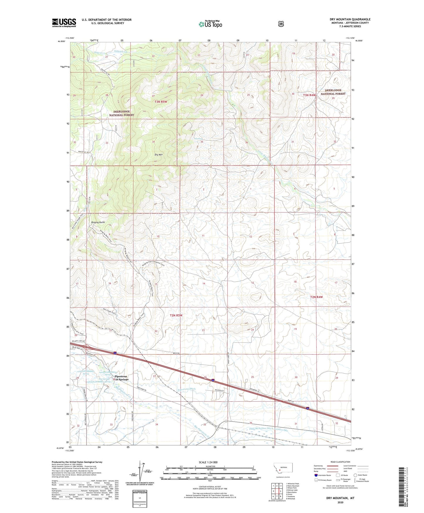
2020 topographic map quadrangle Dry Mountain in the state of Montana. Scale: 1:24000. Based on the newly updated USGS 7.5' US Topo map series, this map is in the following counties: Jefferson. The map contains contour data, water features, and other items you are used to seeing on USGS maps, but also has updated roads and other features. This is the next generation of topographic maps. Printed on high-quality waterproof paper with UV fade-resistant inks.
Quads adjacent to this one:
West: Delmoe Lake
Northwest: Whitetail Peak
North: Ratio Mountain
Northeast: Wilson Park
East: Black Butte
Southeast: Whitehall
South: Vendome
Southwest: Grace
Contains the following named places: 02N05W27CBCB01 Well, 02N05W28BBBB01 Spring, 02N05W28BDDD01 Spring, 02N05W28DBBB01 Spring, Blackstone, Bull Mountain State Wildlife Management Area, Caldwell Ranch, Dry Mountain, Easter Lily Mine, Gillespie Creek, Gillespie Ranch, Hot Springs, Iris Seep, Little Pipestone Creek, Paul-McArthur Ditch Number One, Pipestone, Pipestone Campground, Pipestone Ditch, Pipestone Hot Springs, Pipestone Post Office, Pipestone Springs Post Office, Ringing Rocks, Sage Creek, State Highway Department Sandhouse, Tippet Place