MyTopo
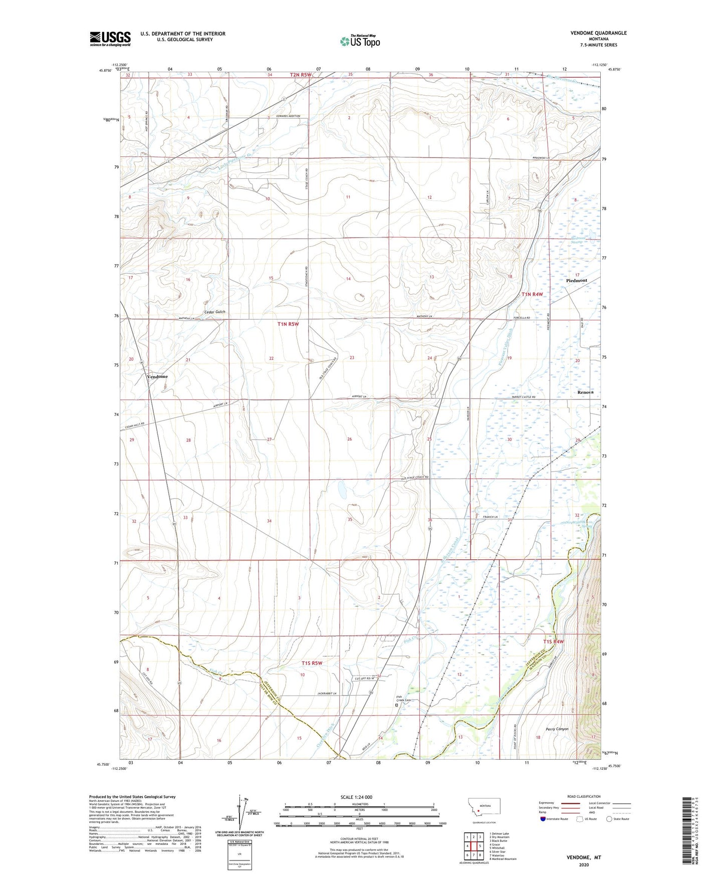
Vendome Montana US Topo Map
Couldn't load pickup availability
Also explore the Vendome Forest Service Topo of this same quad for updated USFS data
2024 topographic map quadrangle Vendome in the state of Montana. Scale: 1:24000. Based on the newly updated USGS 7.5' US Topo map series, this map is in the following counties: Jefferson, Silver Bow, Madison. The map contains contour data, water features, and other items you are used to seeing on USGS maps, but also has updated roads and other features. This is the next generation of topographic maps. Printed on high-quality waterproof paper with UV fade-resistant inks.
Quads adjacent to this one:
West: Grace
Northwest: Delmoe Lake
North: Dry Mountain
Northeast: Black Butte
East: Whitehall
Southeast: Manhead Mountain
South: Waterloo
Southwest: Silver Star
This map covers the same area as the classic USGS quad with code o45112g2.
Contains the following named places: 01N03W03DAA_01 Well, 01N04W07BACA01 Well, 01N04W32DBC_01 Spring, 01N05W03CCAC01 Well, 01N05W22AAAA01 Well, 01N05W24DCCA01 Well, 01S04W06DDBC01 Well, 01S05W14BBBC01 Well, 59759, Cedar Gulch, Delmoe Ditch, Fish Creek, Fish Creek Cemetery, Fish Creek Post Office, Hope Post Office, Jefferson Canal, NE SW Section 29 Mine, Perry Canyon, Piedmont, Piedmont Post Office, Piedmont Swamp, Pleasant Valley Ditch, Renova, Renova Post Office, SW NW Section 16 Mine, Vendome