MyTopo
Fox Creek Montana US Topo Map
Couldn't load pickup availability
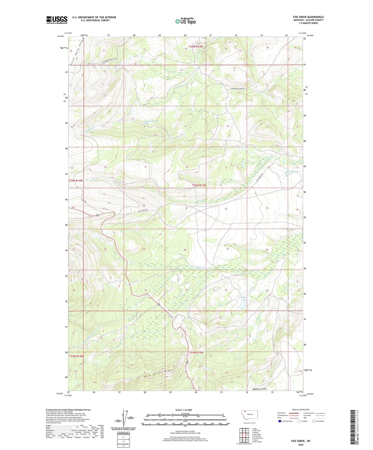
2024 topographic map quadrangle Fox Creek in the state of Montana. Scale: 1:24000. Based on the newly updated USGS 7.5' US Topo map series, this map is in the following counties: Glacier. The map contains contour data, water features, and other items you are used to seeing on USGS maps, but also has updated roads and other features. This is the next generation of topographic maps. Printed on high-quality waterproof paper with UV fade-resistant inks.
Quads adjacent to this one:
West: Saint Mary
Northwest: Babb
North: Duck Lake
Northeast: Wetzel
East: Horse Lake
Southeast: Starr School
South: Kiowa
Southwest: Cut Bank Pass
This map covers the same area as the classic USGS quad with code o48113f3.
Contains the following named places: 34N13W08BDDD01 Spring, 34N13W14DADC01 Spring, Josephine Lake, Milk River Ridge