MyTopo
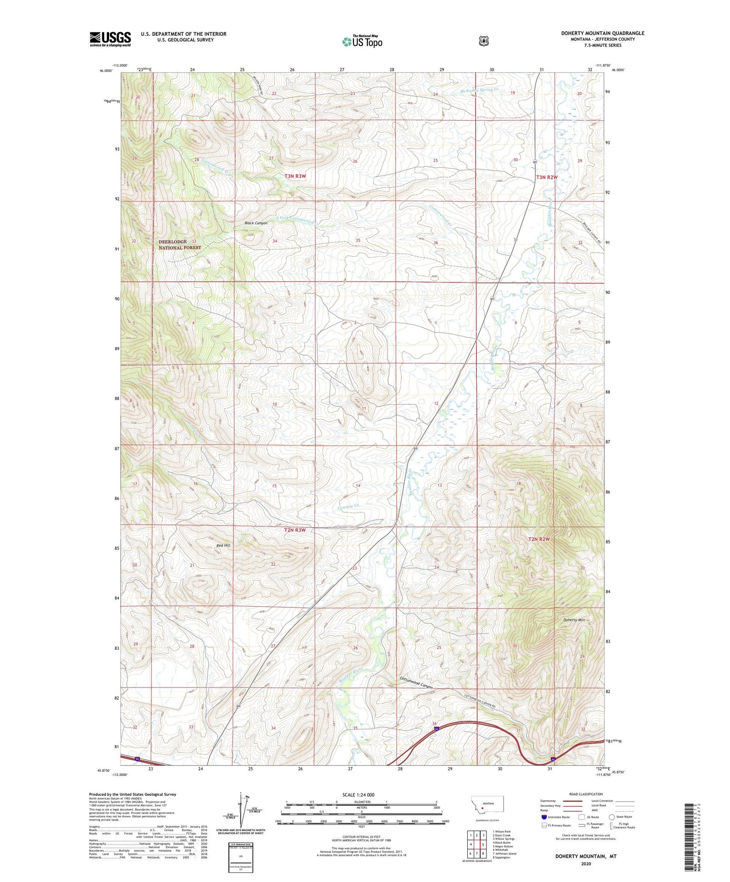
Doherty Mountain Montana US Topo Map
Couldn't load pickup availability
Also explore the Doherty Mountain Forest Service Topo of this same quad for updated USFS data
2024 topographic map quadrangle Doherty Mountain in the state of Montana. Scale: 1:24000. Based on the newly updated USGS 7.5' US Topo map series, this map is in the following counties: Jefferson. The map contains contour data, water features, and other items you are used to seeing on USGS maps, but also has updated roads and other features. This is the next generation of topographic maps. Printed on high-quality waterproof paper with UV fade-resistant inks.
Quads adjacent to this one:
West: Black Butte
Northwest: Wilson Park
North: Dunn Creek
Northeast: Willow Springs
East: Negro Hollow
Southeast: Sappington
South: Jefferson Island
Southwest: Whitehall
This map covers the same area as the classic USGS quad with code o45111h8.
Contains the following named places: 02N03W12CACD01 Well, 02N03W12CADC01 Well, 02N03W15CBC_01 Well, 02N03W22DCDD01 Well, 02N03W23DDBD01 Well, 03N02W29CDBC01 Well, Black Canyon, Brenner Ranch, Cold Spring, Cold Spring Post Office, Cold Springs School, Conrow Creek, Cottonwood Canyon, Cottonwood Creek, Dawson Ranch, Doherty Mountain, Elliott Ranch, Frisbe Mine, Mayne Ranch, McKanna Spring Creek, Pryor Ranch, Red Hill, Shafthouse Hill Mine, South Fork Cottonwood Creek