MyTopo
Cliff Lake Montana US Topo Map
Couldn't load pickup availability
Also explore the Cliff Lake Forest Service Topo of this same quad for updated USFS data
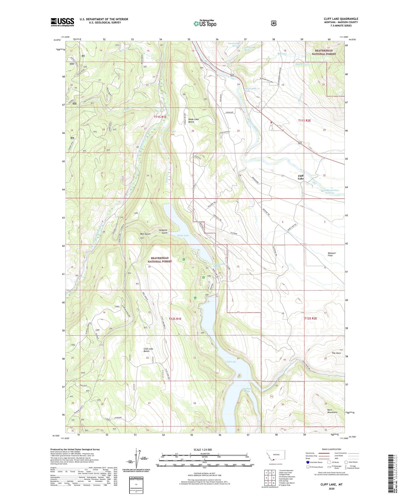
2024 topographic map quadrangle Cliff Lake in the state of Montana. Scale: 1:24000. Based on the newly updated USGS 7.5' US Topo map series, this map is in the following counties: Madison. The map contains contour data, water features, and other items you are used to seeing on USGS maps, but also has updated roads and other features. This is the next generation of topographic maps. Printed on high-quality waterproof paper with UV fade-resistant inks.
Quads adjacent to this one:
West: Freezeout Mountain
Northwest: Granite Mountain
North: Bad Luck Creek
Northeast: Hilgard Peak
East: Earthquake Lake
Southeast: Targhee Peak
South: Hidden Lake Bench
Southwest: Elk Springs
This map covers the same area as the classic USGS quad with code o44111g5.
Contains the following named places: 11S01E13DBC_01 Spring, 11S01E24DBD_01 Spring, 11S02E30BDCD01 Well, 11S02E32DCDC01 Spring, 12S01E11ADD_01 Spring, Antelope Prong, Bogus Creek, Butte Creek, Cliff Lake, Cliff Lake Bench, Cliff Lake Post Office, Cliff Lake School, Cliff Point Campground, Curlew Creek, Deadman Creek, Elliots Resort, Freezeout Creek, Grahams Place, Hilltop Campground, Horn Creek, Jackpine Gulch, Lake Creek, Madison River Lodge, Madison Valley Rural Fire Department Station 2, Missouri Flats, Neelys Camp, Pine Butte Lodge, Schusters Place, Smith Lake, Soap Creek, Trout Creek, Wade Lake, Wade Lake Bench, Wade Lake Camp Grounds, Well Gulch, Wickadahl Ranch