MyTopo
Hidden Lake Bench Montana US Topo Map
Couldn't load pickup availability
Also explore the Hidden Lake Bench Forest Service Topo of this same quad for updated USFS data
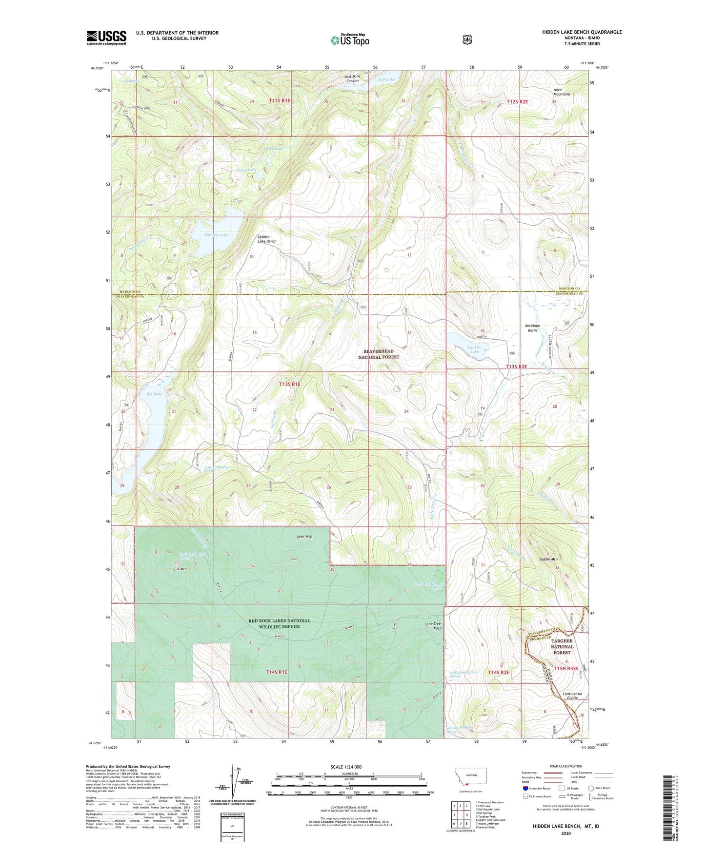
2024 topographic map quadrangle Hidden Lake Bench in the state of Montana. Scale: 1:24000. Based on the newly updated USGS 7.5' US Topo map series, this map is in the following counties: Beaverhead, Madison, Fremont. The map contains contour data, water features, and other items you are used to seeing on USGS maps, but also has updated roads and other features. This is the next generation of topographic maps. Printed on high-quality waterproof paper with UV fade-resistant inks.
Quads adjacent to this one:
West: Elk Springs
Northwest: Freezeout Mountain
North: Cliff Lake
Northeast: Earthquake Lake
East: Targhee Peak
Southeast: Sawtell Peak
South: Mount Jefferson
Southwest: Upper Red Rock Lake
This map covers the same area as the classic USGS quad with code o44111f5.
Contains the following named places: 13S01E28AACD01 Spring, 13S01E33AAC_01 Spring, 13S01E36DDD_01 Spring, 14S02E06CCCB01 Spring, 14S02E07CBAD01 Spring, Antelope Basin, Antelope Creek, Anthill Creek, Brimstone Creek, Conklin Lake, Deer Mountain, Elk Lake, Elk Mountain, Goose Lake, Hidden Lake, Hidden Lake Bench, Hidden Lake Camp Ground, Horn Mountains, Limestone Creek, Lone Tree Creek, Lone Tree Pass, Lost Mine Canyon, Lost Spring, Orr Ranch, Otter Lake, Poison Creek, Saddle Mountain, Spring Branch