MyTopo
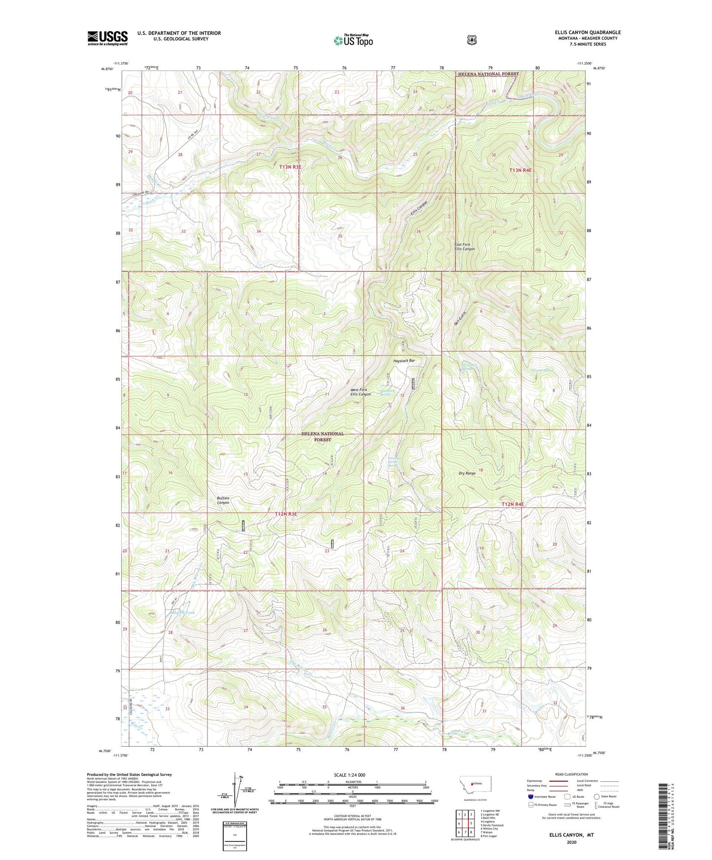
Ellis Canyon Montana US Topo Map
Couldn't load pickup availability
2020 topographic map quadrangle Ellis Canyon in the state of Montana. Scale: 1:24000. Based on the newly updated USGS 7.5' US Topo map series, this map is in the following counties: Meagher. The map contains contour data, water features, and other items you are used to seeing on USGS maps, but also has updated roads and other features. This is the next generation of topographic maps. Printed on high-quality waterproof paper with UV fade-resistant inks.
Quads adjacent to this one:
West: Lingshire
Northwest: Lingshire NW
North: Lingshire NE
Northeast: Bald Hills
East: Devils Footstool
Southeast: Fort Logan
South: Watson
Southwest: Whites City
Contains the following named places: Ashford Tank, Dabler Dam, Den Gulch, Den Gulch Spring, Dry Beaver Creek, Dry Range, East Fork Ellis Canyon, Ellis Canyon, Freeman Creek, Haystack Bar, Haystack Spring, Middle Creek, Rock Creek, Weaning Corral Spring, West Fork Ellis Canyon, Weston Spring, Willow Springs Post Office